Archive for the 'Cuttack-Paradip' Category

Work starts on Paradeep-Choudwar-Rourkela Industrial Corridor

Angul, Anugul- Talcher - Saranga- Nalconagar, Bhubaneswar- Cuttack- Puri, Bhubaneswar-Dhenkanal- Anugul, CKP ... Bhalulata - Rourkela - Jharsuguda Jn - Daghora , Cuttack, Cuttack - Paradeep, Cuttack-Paradip, Dhenkanal, IDCO, Jajpur, Jharsuguda-Sambalpur- Bargarh, Jharsugurha, Jharsugurha- Brajarajnagar- Belpahar, Kendrapada, Khordha, Paradeep port, Paradip - Jatadhari - Kujanga, Rourkela- Kansbahal, Rourkela-Jharsuguda, Sambalpur, Sambalpur - Talcher, Sambalpur-Burla-Jharsuguda, Sambaplur- Burla- Bargarh- Chipilima, Sundergarh, Talcher - Barang, Talcher - Bimlagarh (under constr.) 1 Comment »

Following is an excerpt from a report in ibnlive.com.

The state government has started work on development of a railway corridor through Choudwar to Rourkela to allow ease of inward and outward transportation of goods from the industrial hubs and mining belts along the region.

Land acquisition for the project, the first of its kind initiative by a state government, has already been initiated by the Industrial Infrastructure Development Corporation (Idco). The project would go on ground after the land acquisition and is targeted to be completed by 2015, said Idco CMD Priyabrata Patnaik on Friday.

The corridor involves development of extensive rail and road connectivity, along with provisioning of water supply and other infrastructural facilities. The corridor would encompass two track railway lines and six-lane road passing through the industrial hubs and the coal mining belts. New industrial areas and downstream units would be developed along the corridor.

Common infrastructure facilities under the corridor would solve the problems of inward and outward transportation of goods and minerals. The stretch would pass through the heart of coal mining operations in the state, which harbours about 65 billion tonne of reserves. The coal reserves in the Talcher belt only is around 43 billion tonne.

The corridor would cover 17 large and mega-industries, along with 57 other units, through the stretch from Choudwar to Rourkela. Traffic projection on the route is given out as 8.7 million tonne.

The route would have 163 km of railway track length and 465 km on road. As many as 308 minor bridges and 77 major bridges would have to be constructed on it, said Patnaik.

Note 1: The 163 km of railway track probably refers to the Talcher-Bimlagarh segment.

Note 2: Although the above report only mentions the Choudwar-Rourkela part, in earlier documents there is mention of Paradeep-Choudwar-Rourkela industrial corridor. See for example this 2009 Business Standard report. Following are some excerpts from that.

The Orissa government plans to develop an industrial corridor running from Paradeep to Rourkela through industrial hubs like Choudwar, Talcher and Sambalpur.

Though the initial proposal was to have an industrial corridor originating from Choudwar to Rourkela, the proposal was modified to extend the corridor till Paradeep to allow inward and outward transport of goods through the Paradeep port, sources said.

… The proposed industrial corridor will be in line with the Delhi-Mumbai Industrial Corridor and is designed to pass through national highway no.42 and national highway no 5 (A).

Under the project, both road and rail corridor will be developed, which will be the backbone of the proposed project. The industrial estates and down stream units would be developed over 25 km area on both sides of the corridor.

IL&FS has been appointed as the consultant for the project and it has already submitted the pre-feasibility study report to the industry department on the project. However, the detail cost of the project is yet to be worked out yet, sources added.

The latest initiative of the state government follows a similar initiative to develop a common ‘rail-road-water pipeline and infrastructure corridor’ in Meramundali-Angul-Talcher-Chhendipada belt, to facilitate movement of coal in the Talcher coalfield area.

The project is estimated to cost about Rs 5000 crore including Rs 2000 crore for 2-line rail corridor and Rs 1100 crore for 4 lane road alongside it. The land width of the proposed corridor will be 300 metre which includes 60 metre for road and 20 metre for water pipeline.

The total length of the corridor is 137 kilometre which includes length of 43 number of major bridges to be constructed on this stretch. RITES Ltd has already submitted a pre-feasibility report to the state owned Industrial Infrastructure Development Corporation of Orissa Ltd. (Idco) on the project.

The project is designed to have multi-point centralised loading stations conceived along the corridor rather than individual bulb connections with a view to avoid interference or wastage of coal bearing areas. Road and water pipe alignment will run parallel to rail alignment, sources said.

It will be connected to rail line at three locations- Jharpada, Angul and Budhapanka. The common corridor will have multiple entry and exit points and no surface crossing. Besides, flyovers are proposed to avoid cross movements at junction stations.

This ‘rail-road-water pipeline and infrastructure corridor’ in Meramundali-Angul-Talcher-Chhendipada belt is projected to handle 113 million tonne coal by 2014-15. It includes 55 million tonne coal movement required by the power companies, 40.76 million tonne by steel companies and 17.22 million tonne by other industries.
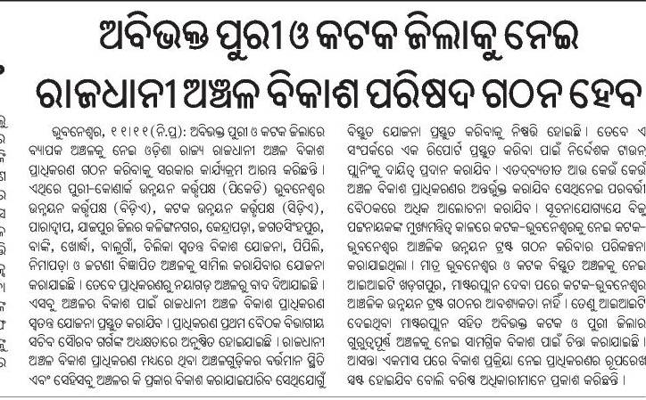
Odisha initiates plans for a Capital Area Development Region

Bhubaneswar, Bhubaneswar- Cuttack- Puri, Bhubaneswar-Berhampur, Bhubaneswar-Cuttack- Kalinganagar, Bhubaneswar-Dhenkanal- Anugul, Bhubaneswar-Nayagarh, Bhubaneswar-Paradip, Bhubaneswar-Pipli- Astaranga, Bhubaneswar-Pipli- Konark, Bhubaneswar-Puri, Choudwar-Kendrapara - Dhamara, Cuttack, Cuttack, Cuttack-Paradip, Dhenkanal, Jagatsinghpur, Jajpur, Jajpur Rd- Vyasanagar- Duburi- Kalinganagar, Kalinganagar - Panikoili - Jajpur - Kendrapara, Kalinganagar- Chandikhol- Paradip, Kendrapada, Khordha, Odisha govt. action, Paradip - Jatadhari - Kujanga, Puri, Puri, Puri - Konark, URBAN DEV. & RENEWAL 1 Comment »

The above is a good idea.


  • A plan over a larger area will avoid congestion and slums that are typical of densly packed areas.
  • Another big benefit will be that the term "Capital Area" will make it easier for institutions, companies and other entities to come to the gretaer area rather than coming to "Bhubaneswar". For example, many institutions that are looking for land in Bhubaneswar are hesitant to locate in Kendrapada or Jagatsinghpur; even though the political leadership is very welcoming.  But once the term "Capital Area" encompasses Kendrapada and Jagatsinghpur, these institutions will be less hesitant to come there.

So while the current Bhubaneswar and Cuttack planned areas will sever as the core urban area, the larger Capital Area development region will morph to a sub-urban area which down the road will touch the metropolitan areas around Angul in the west and Berhampur in the south.

We wrote about this in http://www.orissalinks.com/orissagrowth/archives/3637.

A similar term needs to be coined for the greater Sambalpur-Jharsuguda-Rourkela area. See http://www.orissalinks.com/orissagrowth/archives/3660 , http://www.orissalinks.com/orissagrowth/archives/3672 and http://www.orissalinks.com/orissagrowth/archives/3668.

Perhaps it can be called the "Western Odisha Development Region".

A 25 crore overbridge to be built in Cuttack: Samaja

Bhubaneswar- Cuttack- Puri, Cuttack, Cuttack-Paradip, Roads, highways and Bus stands, Samaja (in Odia) Comments Off on A 25 crore overbridge to be built in Cuttack: Samaja

Industrialization of the Paradip area and their land requirements

Chemicals, Cuttack - Paradeep, Cuttack-Paradip, Fertilizers, Haridaspur - Paradeep (under constr.), Jagatsinghpur, Jatadhari port (POSCO), Land acquisition, Paradeep port, Paradip - Jatadhari - Kujanga, Petrochemicals, Ports and waterways, POSCO, R & R, REAL ESTATE, Steel 1 Comment »

Following are extracted from a report in the Pioneer.

  • the State Commerce and Transport Department, in its sanction order-29753, dated May 30, 1970, had allotted 3, 793.21 acres in the first phase and 2285.23 acres in the second phase to the Paradip Port Project. Most of the lands were obtained from Sandhakuda, Bijayachandrapur, Balijhari and Bhitaragara villages, under Kujang Tehsil. According to the official sources, about 6,889 acres of land were supplied to the Paradip Port Trust.
  • The State Government had provided 62.19 acres of land to the Paradeep Phosphate Ltd, which is a fertiliser plant that started its project in 1982. The PPL had acquired 405 acres of private lands from Bhitaragada village on its own.
  • … in Paradeep-Cuttack railway line 137 acres of land were acquired from the Bhitaragada village.
  • Kujang Tehsil had about 1,500 acres of Government land in the Musadiha area that was provided to the Oswal Fertiliser Plant in the year 1995-96. The plant had also purchased about 500 acres of private land from the local people.
  • … in 2000 Indian Oil Corporation had purchased 3,300 acres of private land from the local people of 17 villages for its refinery project, which was to be set up on the outskirts of Paradip but the project is yet to come.
  • for much-hyped Haridaspur-Paradip Railway Project, widening of the NH-5 and recent expansion of Cuttack-Paradip State Highway, thousands of acres of both Government and private lands have been acquired from Kujang Tehsil.
  • Essar, the 6 million tonnes steel plant project, moves for the land acquisition in Paradip and the project needs about 1,950 acres of land. The State Government has already given 350 acres of land to the plant. It will procure the remaining required land from private land.
  • Posco has shown a demand of about 4,004 acres of land in Dhinkia, Gadakujang and Nuagaon villages for its steel plant and port project. The State Government has given assurance and has provided Posco most of the encroached Government and forestlands. The rest of the required land would be purchased from private landowners.

Railways around Greater Bhubaneswar

Angul, Bhadrakh-Sarla Rd...Vizag, Bhubaneswar and vicinity, Bhubaneswar- Cuttack- Puri, Bhubaneswar-Berhampur, Bhubaneswar-Cuttack- Kalinganagar, Bhubaneswar-Dhenkanal- Anugul, Bhubaneswar-Nayagarh, Bhubaneswar-Puri, Corridors emanating from Bhubaneswar metro, Cuttack, Cuttack - Paradeep, Cuttack-Paradip, Dhenkanal, ECOR, Ganjam, Haridaspur - Paradeep (under constr.), Jagatsinghpur, Jajpur, Kendrapada, Khordha, Khurda Rd - Balangir (under constr.), Khurda Rd - Puri, Nayagarha, Puri, Puri - Konark, Railway maps, Rajathagara - Nergundi, Talcher - Barang Comments Off on Railways around Greater Bhubaneswar

ecor-status-april1-2007-greater-bbsr.JPG

A map of Bhubaneswar and vicinity

Anugul- Talcher - Saranga- Nalconagar, Bhadrakh, Bhadrakh-Balasore, Bhadrakh-Dhamara, Bhubaneswar and vicinity, Bhubaneswar- Cuttack- Puri, Bhubaneswar-Berhampur, Bhubaneswar-Cuttack- Kalinganagar, Bhubaneswar-Dhenkanal- Anugul, Bhubaneswar-Nayagarh, Bhubaneswar-Paradip, Bhubaneswar-Pipli- Astaranga, Bhubaneswar-Pipli- Konark, Bhubaneswar-Puri, Choudwar-Kendrapara - Dhamara, Corridors emanating from Bhubaneswar metro, Cuttack, Cuttack-Paradip, Dhenkanal, Ganjam, Jagatsinghpur, Jajpur, Jajpur Rd- Vyasanagar- Duburi- Kalinganagar, Kalinganagar- Chandikhol- Paradip, Kalinganagar-Bhadrakh, Kendrapada, Khordha, Nayagarha, Puri, Puri - Konark, Railway maps, Road maps, TOURISM, ENTERTAINMENT and SHOPPING Comments Off on A map of Bhubaneswar and vicinity

Roads and Highways infrastructure in Orissa

Angul, Balangir, Balasore, Bargarh, Baripada-Balasore-Kirtania, Bhadrakh, Bhadrakh-Balasore, Bhadrakh-Dhamara, Bhubaneswar-Berhampur, Bhubaneswar-Cuttack- Kalinganagar, Bhubaneswar-Dhenkanal- Anugul, Bhubaneswar-Nayagarh, Bhubaneswar-Paradip, Bhubaneswar-Pipli- Astaranga, Bhubaneswar-Pipli- Konark, Bhubaneswar-Puri, Bouda, Choudwar-Kendrapara - Dhamara, Coastal highway, Corridors emanating from Bhubaneswar metro, Cuttack, Cuttack-Paradip, Deogarh, Dhenkanal, DISTRICTS & BLOCKS, Gajapati, Ganjam, Grama sadak, Jagatsinghpur, Jajpur, Jharsuguda-Sambalpur- Bargarh, Jharsugurha, Kalahandi, Kalinganagar - Kamkhya Nagar - Talcher, Kalinganagar - Panikoili - Jajpur - Kendrapara, Kalinganagar - Tarini - Keonjhar, Kalinganagar- Chandikhol- Paradip, Kalinganagar-Bhadrakh, Kandhamala, Kendrapada, Keonjhar, Khordha, Koraput, Malkangiri, Mayurbhanj, Mining Corridor, Nabarangpur, National Highways, Nayagarha, NH 200 (440 Kms: Chhattisgarh - Jharsuguda - Deogarh - Talcher - Kamakhyanagar - Duburi - Chandhikhol), NH 201 (310 Kms: Boriguma - Bhawanipatna - Balangir - Bargarh), NH 203 (97 Kms: Bhubaneshwar-Pipili-Puri-Konark), NH 203A (49 Kms: Puri - Bramhagiri - Satpada), NH 215 (348 Kms: NH-5@Panikoli - Anandapur - Kendujhargarh -Rajamundra @NH-23), NH 217 (438 Kms: Chhattisgarh Border - Khariar Rd - Nuapada - Khariar - Titlagarh - Ramapur - Baligurha - Asika - Brahmapur - Gopalpur), NH 224 (298 Kms: Khordha - Nayagarh - Dashapalla - Bauda - Sonapur - Balangir), NH 23 (209 Kms: Jharkhand Border - Rourkela - Rajamundra - Pala Laharha - Talcher - NH-42), NH 42 (261 Kms: NH-6@Sambalpur - Redhakhol - Anugul - Dhenkanal - NH-5@Nergundi), NH 43 (152 Kms: Chhattisgarh Border - Chandili - Borigma - Jaypur - Koraput - Sunki - Andhra Pradesh Border), NH 5 (488 kms: NH No.6 in Jharkhand - Baripada - Baleshwar - Bhadrakh - Cuttack - Bhubaneswar - Khordha - Brahmapur - upto Andhra Pradesh Border), NH 5A (77 Kms: NH-5 at Chandikhol to Paradip), NH 6 (462 Kms: Chhattisgarh Border - Lobarchatti - Bargarh - Sambalpur - Deogarh - Kendujhargarh - Jashipur - Bangriposi - Jharkhand Border ), NH 60 (57 Kms: West Bengal Border- Jaleswar - Baleshwar), NH 75 (18 Kms: Jharkhand Border to NH-215 near Parsora), Nuapada, Overall Odisha, Puri, Puri - Konark, Rayagada, Road maps, Roads, highways and Bus stands, Rourkela-Jharsuguda, Sambalpur, Sonepur, State highways, Sundergarh, Vijaywada-Ranchi highway Comments Off on Roads and Highways infrastructure in Orissa


In recent years there has been a big jump in the number of kilometers of national highways in Orissa. Following is copied from my page "Roads and Highways infrastructure in Orissa."

Road network: Orissa Roads1; Orissa Roads2; India’s NH network; India’s golden quadrilateral; the part of the GQ/NH-5 that runs through Orissa.

  • National Highways in Orissa and India; its growth in recent years:
    • NH 5: Junction with NH No.6 in Jharkhand near Baharagora-BaripadaBaleshwar-Bhadrakh-Cuttack- Bhubaneswar-Khordha-Chhatrapur-Brahmapur– upto Andhra Pradesh Border. (488 kms)
    • NH 5A: Junction with NH No.5 near Haridaspur-Paradip Port. (77 kms)
    • NH 6: From Chhattisgarh Border-Lobarchatti- BargarhSambalpur-Deogarh-Barakot- Kendujhargarh -Jashipur-Bangriposi-upto Jharkhand Border (462 kms)
    • NH 23: From Jharkhand Border-Panposh-Raurkela– Rajamundra-Barakot- Pala Laharha-Talcher-Jn. with NH-42 (209 kms)
    • NH 42: Junction with NH No.6 near Sambalpur– Redhakhol-Anugul-Dhenkanal- Jn. with NH-5 near Cuttack. (261 kms)
    • NH 43: From Chhattisgarh Border– Dhanpunji- Borigma- JaypurKoraput-Sunki- Andhra Pradesh Border. (152 kms)
    • NH 60: From West Bengal BorderJaleswarBaleshwar (57 kms)
    • NH 75: From Jharkhand Border to junction with NH No.215 near Parsora (18 kms)
    • NH 200: From Chhattisgarh-Machida-Jharsuguda– Kochinda- Deogarh –Talcher-Kamakhyanagar-Sukinda- Chandhikhol (440 kms)
    • NH 201: Boriguma-Ampani-Bhawanipatna– Belgan- Balangir-Luisinga-Jogisuruda-Dunguripali-Bargarh (310 kms)
    • NH 203: Bhubaneshwar-Pipili-PuriKonark (97 kms)
    • NH 203A: The highway starting from its junction with NH-203 at Puri, connecting Bramhagiri and terminating at Satpada (49 kms)
    • NH 215: Panikoli-Anandapur-Ghatgan- Kendujhargarh– Parsora-Koira-Rajamundra (348 kms)
    • NH 217: From Chhattisgarh Border-Nauparha-Khariar- Titlagarh-Belgan- Ramapur- Baligurha-Sorada-Asika- Brahmapur– Narendrapur- Gopalpur (438 kms)
    • NH 224: Khordha-Nayagarh-Dashapalla- Purunakatak-Bauda-Sonapur-Balangir (298 kms)
  • Vijaywada-Ranchi highway (approved by planning commission as reported in May 2006), [July 06] [The Orissa government has been demanding a NH from Vijaywada to Ranchi which will pass through the Naxal infested areas. 1200 km of this 2000km will be in Orissa. CM talked to planning comission about it.]
  • Ongoing National Highway work in Orissa
  • Future plans for Orissa: [1:april-28-05]; [2:april-28-05].
  • Various phases of NHDP: [1]; [2]; [3]
  • Other highway plans:
    • 4 laning of Chandikhol-Paradip by February-end of 2007
    • 4 laning of Keonjhar-Panikoili, Duburi-Talcher, Cuttack-Paradeep and Duburi-Keonjhar Highways. [June17-05-Pragativadi]
  • Aim-for-with-high-priority/parts-of-it-in-Orissa-govt- plan(page4)-already:
    • Connect NH 215 (perhaps at Jajpur Rd) to Jenapur to NH200 (where it meets Brahmani) with a highway as Jenapur is the location where the National waterway will cross the railway line and Jenapur is 7 kms from where a branch of the line goes to Daitari and Bansapani.
    • Designate AP-border-Koraput-Raygada-Padampur- Berhampur (in NH5) as a National highway. (This will bring Koraput and Raygada, thus a big part of KBK, closer to BBSR) — a slight revision of what is in the plan
    • Designate Anandpur (NH 215)-Bhadrak-Dhamara port as an NH. (This will bring Dhamara port closer to Jharkhand, thus helping industries in Jharkhand and Orissa.)
    • Jagatpur-Kendrapara-Chandbali-Dhamara — make it an NH (alternative route to Dhamara port)
    • Panikoili/Kuakhia-Jajpur-Aradi-Chandabali — make it an NH (alternative route to Dhamara port)
    • Panikoili-Jajpur-Kendrapara-NH5a-Paradeep — make it an NH (alternative to Paradeep port)
  • Orissa State Road Transport Company (OSRTC)
  • Wide city roads:
    • Four-laning of the Airport-Dhamana Chhaka road in Bhubaneswar: [1]
    • Other Bhubaneswar Road plans: [1], [2]
  • Bhubaneswar area road plans: