Archive for the 'MAPs' Category

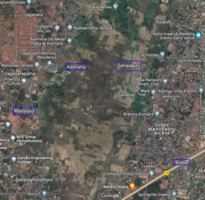
A masterplan for a site near Infovalley

Bhubaneswar and vicinity, Bhubaneswar- Cuttack- Puri, Khordha, Satellite and Residential townships Comments Off on A masterplan for a site near Infovalley

Google Map Link: https://www.google.com/maps/@20.2471662,85.7396776,3429m/data=!3m1!1e3

In Design Studio Ahmedabad has developed a master plan for the above area. See details at https://www.inidesignstudio.info/dev/portfolio/town-planning-scheme-tps-02-bhubaneswar/

The districts of Odisha that are behind and need special attention

Overall Odisha 7 Comments »

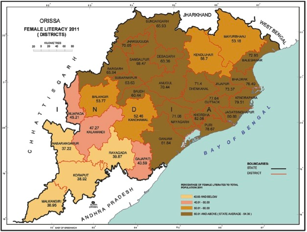
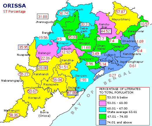
We present a set of maps that illustrate the districts that are behind the rest of the state and that need special attention.

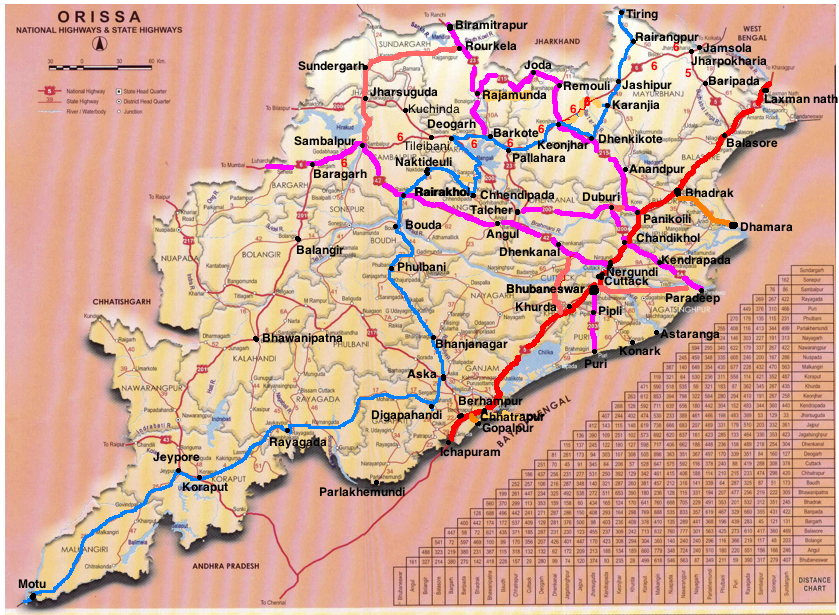
In the following map the blue path is the divided 2 lane Vijaywada-Ranchi highway; the red one, already a 4-lane highway as part of the Golden Quadrilateral will become a 6-lane highway; and the orange (state/PPP funded) and pink (part of NHDP) ones will be 4-lane highways.

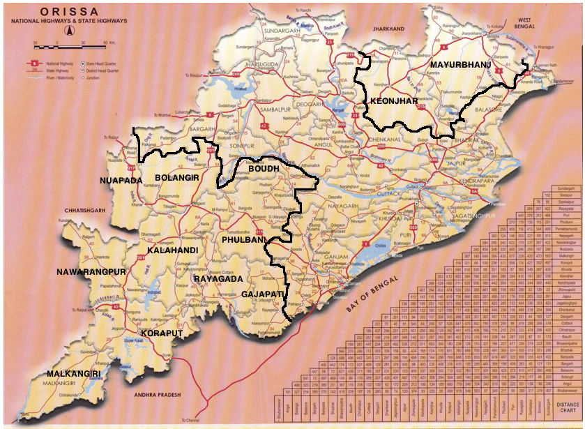
Based on the above data the backward districts of Odisha are clustered in the north and south as given in the map below.

NHDP (National Highways Development Project) and Odisha

Bhubaneswar - Paradeep, Capital Region Ring Road (CRRR), Coastal highway, NH 203 (97 Kms: Bhubaneshwar-Pipili-Puri-Konark), NH 215 (348 Kms: NH-5@Panikoli - Anandapur - Kendujhargarh -Rajamundra @NH-23), NH 23 (209 Kms: Jharkhand Border - Rourkela - Rajamundra - Pala Laharha - Talcher - NH-42), NH 42 (261 Kms: NH-6@Sambalpur - Redhakhol - Anugul - Dhenkanal - NH-5@Nergundi), NH 5 (488 kms: NH No.6 in Jharkhand - Baripada - Baleshwar - Bhadrakh - Cuttack - Bhubaneswar - Khordha - Brahmapur - upto Andhra Pradesh Border), NH 5A (77 Kms: NH-5 at Chandikhol to Paradip), NH 6 (462 Kms: Chhattisgarh Border - Lobarchatti - Bargarh - Sambalpur - Deogarh - Kendujhargarh - Jashipur - Bangriposi - Jharkhand Border ), NH 60 (57 Kms: West Bengal Border- Jaleswar - Baleshwar), Overall Odisha, SH 10 Sambalpur - Jharsuguda - Rourkela, State highways, Vijaywada-Ranchi highway 3 Comments »

The various phases of NHDP and their meaning, as obtained from wikipedia,  is as follows:

Phase I: The Golden Quadrilateral (GQ; 5,846 km) connecting the four major cities of Delhi, Mumbai, Chennai and Kolkata.

* In Odisha: Part of the GQ connecting Kolkata to Chennai.

Phase II: North-South and East-West corridors comprising national highways connecting four extreme points of the country. The North-South and East-West Corridor (NS-EW; 7,300 km) connecting Srinagar in the north to Kanyakumari in the south, including spur from Salem to Kanyakumari (Via Coimbatore and Kochi) and Silchar in the east to Porbandar in the west.

* In Odisha None

Phase III: The government recently approved NHDP-III to upgrade 12,109 km (7,524 mi)of national highways on a Build, Operate and Transfer (BOT) basis, which takes into account high-density traffic, connectivity of state capitals via NHDP Phase I and II, and connectivity to centres of economic importance. contracts have been awarded for a 2,075 km (1,289 mi).

* In Odisha (From http://www.nhai.org/nhdpphase3.asp.)

  • Panikholi-Keonjhar- Rimoli, NH 215, 106kms
  • Duburi – Talcher, NH 200, 98kms
  • Bhubneshwar-Puri(Approved Length 59 Km) 203 67
  • Chandikhole-Duburi 200 39
  • Rimoli – Roxy – Rajamunda(Approved Length 163Km) 215 96
  • Sambalpur-Baragarh-Chattisgarh/Orrisa Border 6 88 Balance for award

Phase IV: The government is considering widening 20,000 km (12,000 mi) of highway that were not part of Phase I, II, or III. Phase IV will convert existing single lane highways into two lanes with paved shoulders. The plan will soon be presented to the government for approval.

* In Odisha (From http://www.nhai.org/ppp.htm.)

Phase V: As road traffic increases over time, a number of four lane highways will need to be upgraded/expanded to six lanes. The current plan calls for upgrade of about 5,000 km (3,100 mi) of four-lane roads, although the government has not yet identified the stretches.

* In Odisha (From http://www.nhai.org/nhdpphase5.asp.)

  • Six Laning of Chandikhol-Jagatpur-Bhubaneswar(Approved Length 61 Km) 5 67
  • Dhankuni-Balasore (Orissa portion Balasore – Laxmannath) 2 , 6& 60 235.68
  • Bhubneshwar-Ichchapuram 5 164.33
  • Balasore –Chandikhol 5 138.14


Phase VI: The government is working on constructing expressways that would connect major commercial and industrial townships. It has already identified 400 km (250 mi) of Vadodara (earlier Baroda)-Mumbai section that would connect to the existing Vadodara (earlier Baroda)-Ahmedabad section. The World Bank is studying this project. The project will be funded on BOT basis. The 334 km (208 mi) Expressway between ChennaiBangalore and 277 km (172 mi) Expressway between KolkataDhanbad has been identified and feasibility study and DPR contract has been awarded by NHAI.

* In Odisha: None yet.

Phase VII: This phase calls for improvements to city road networks by adding ring roads to enable easier connectivity with national highways to important cities. In addition, improvements will be made to stretches of national highways that require additional flyovers and bypasses given population and housing growth along the highways and increasing traffic. The government has not yet identified a firm investment plan for this phase.

* In Odisha: None yet.


In addition to the above some of the other major highway development activities are:

The following annotated map shows the above highways on the Odisha map.


The blue path is the divided 2 lane Vijaywada-Ranchi highway; the red one, already a 4-lane highway as part of the Golden Quadrilateral will become a 6-lane highway; and the orange (state/PPP funded) and pink (part of NHDP) ones will be 4-lane highways. I believe soon the remaining parts of NH 5 (for port connectivity to ports in Balasore district) and NH 6  (as it connects Mumbai-Kolkata) will also become 4-lane highways and all the new ports coming up will be connected to the GQ by 4-lane highways.

The concern is the bottom half of Odisha which will not have good roads except the Vijaywada-Ranchi highway. Unless particular attention is paid to that part, it will fall further behind.


The expressway plan at http://www.orissalinks.com/orissagrowth/topics/tnc-all/roads-and-highways-infrastructure-in-orissa/expressways does cover all of Odisha in phases. If parts of it can be expedited then it will help.

Odisha district-wise population and other 2011 census statistics

2011, Overall Odisha 3 Comments »

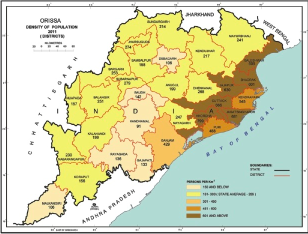
The following is from the Odisha datasheet at censusindia.gov.

Based on the above map, the population of the Capital area consisting of Puri, Cuttack and Khurda districts is about 6.5 million. My guess is that if one draws a radius of 70 kms around the Bhubaneswar Secretariate-Assembly area, then the population of that would be between 5 to 6 million.

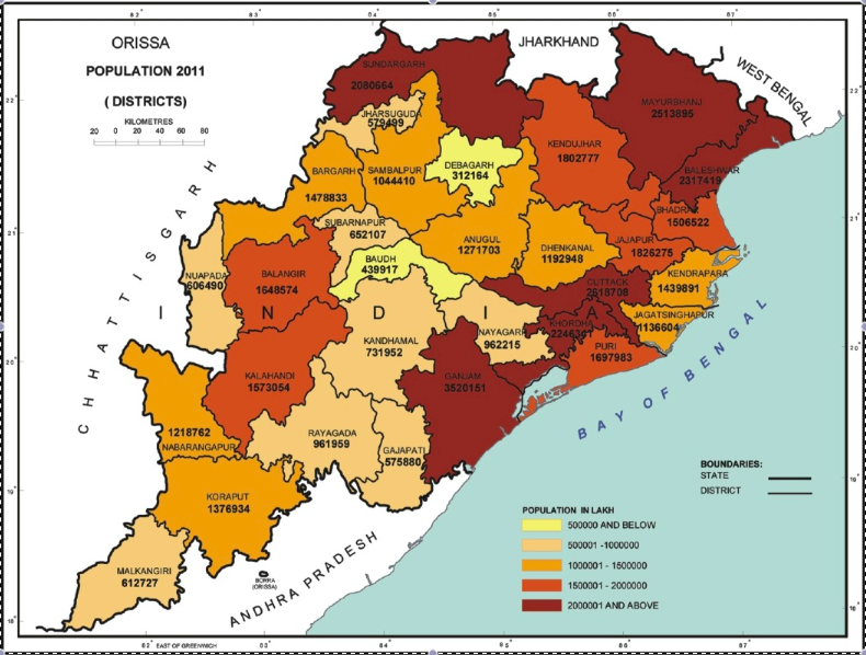
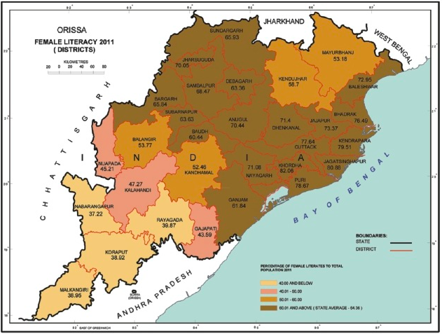
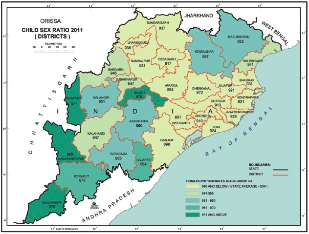
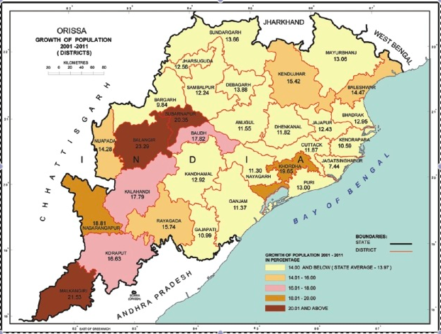
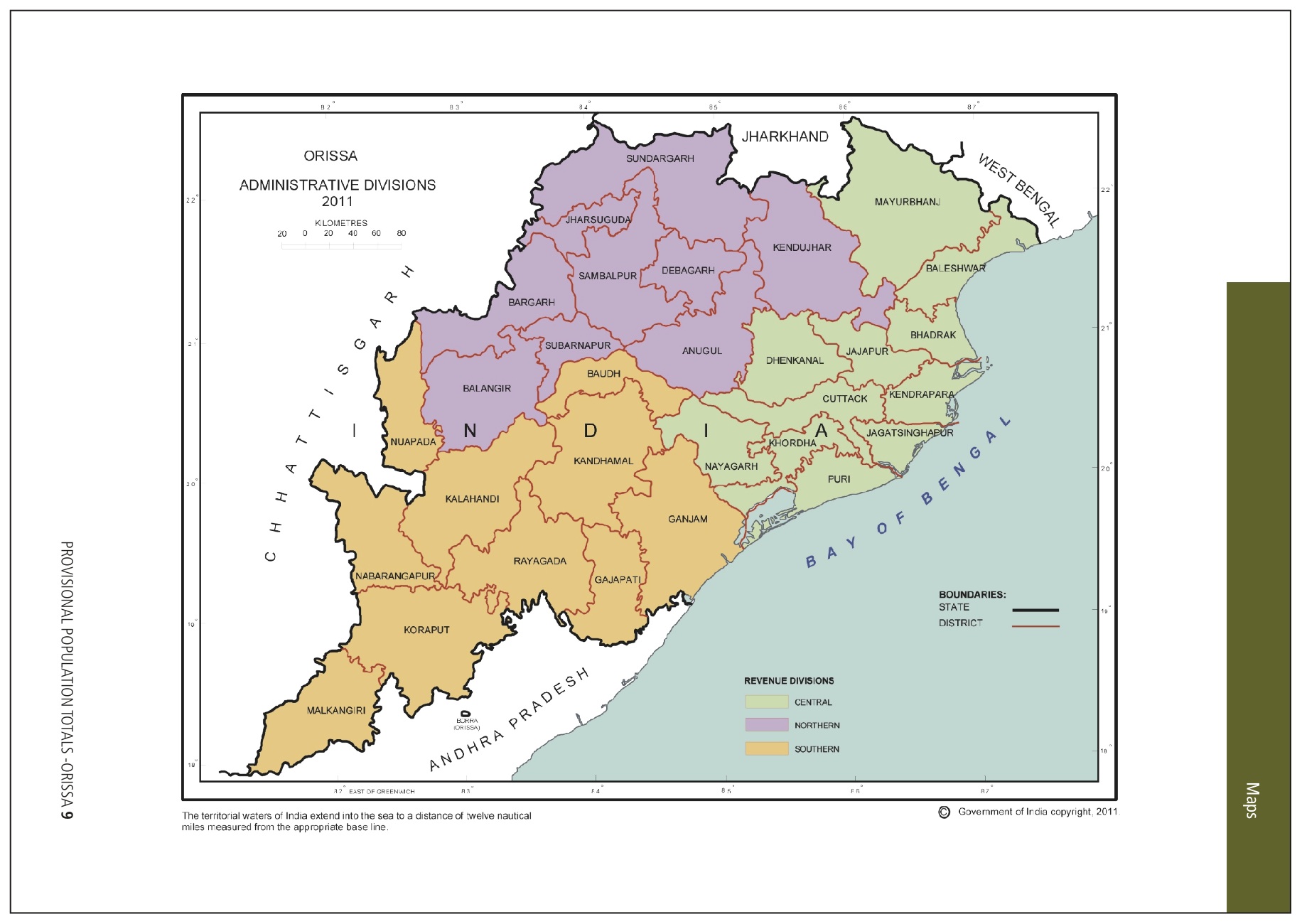
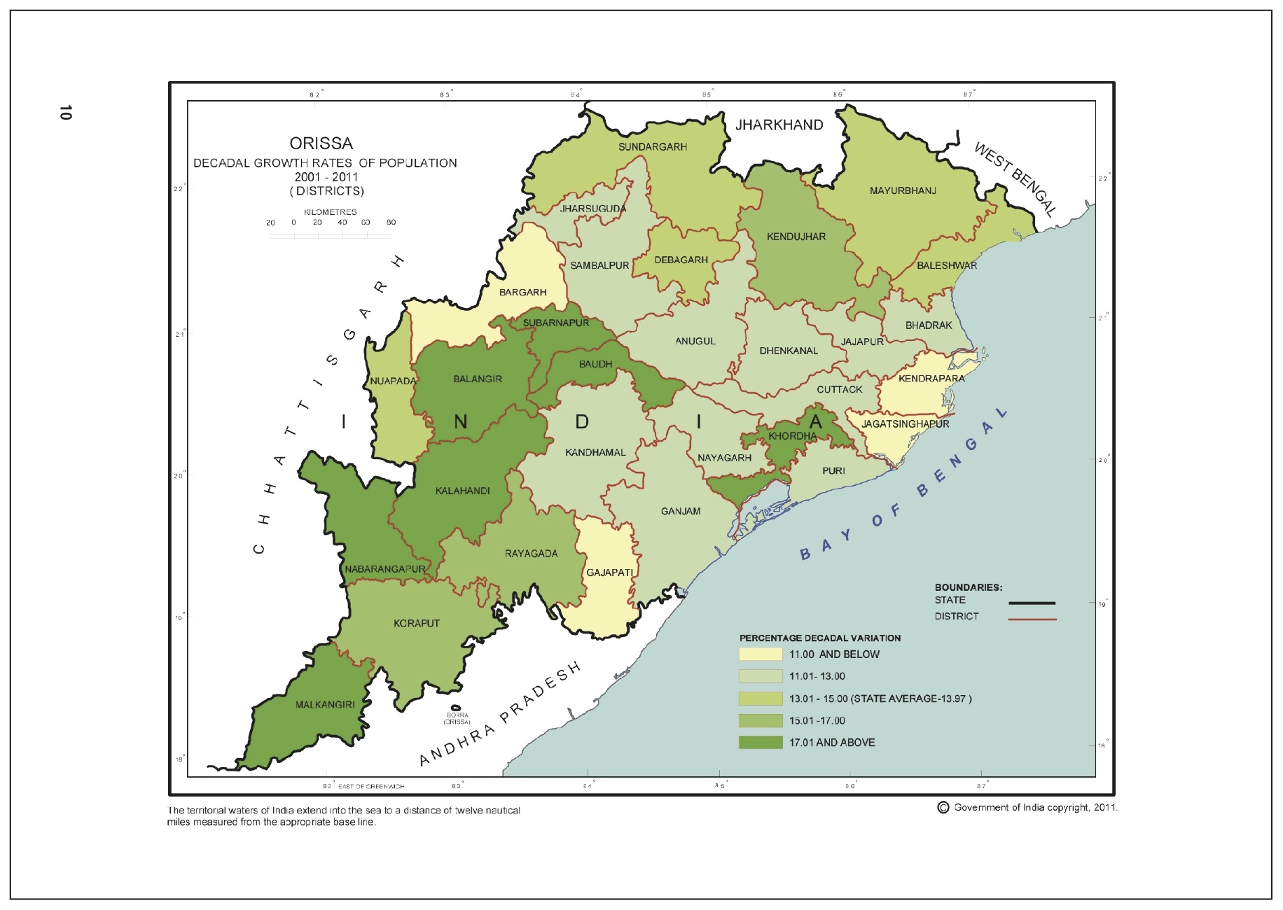
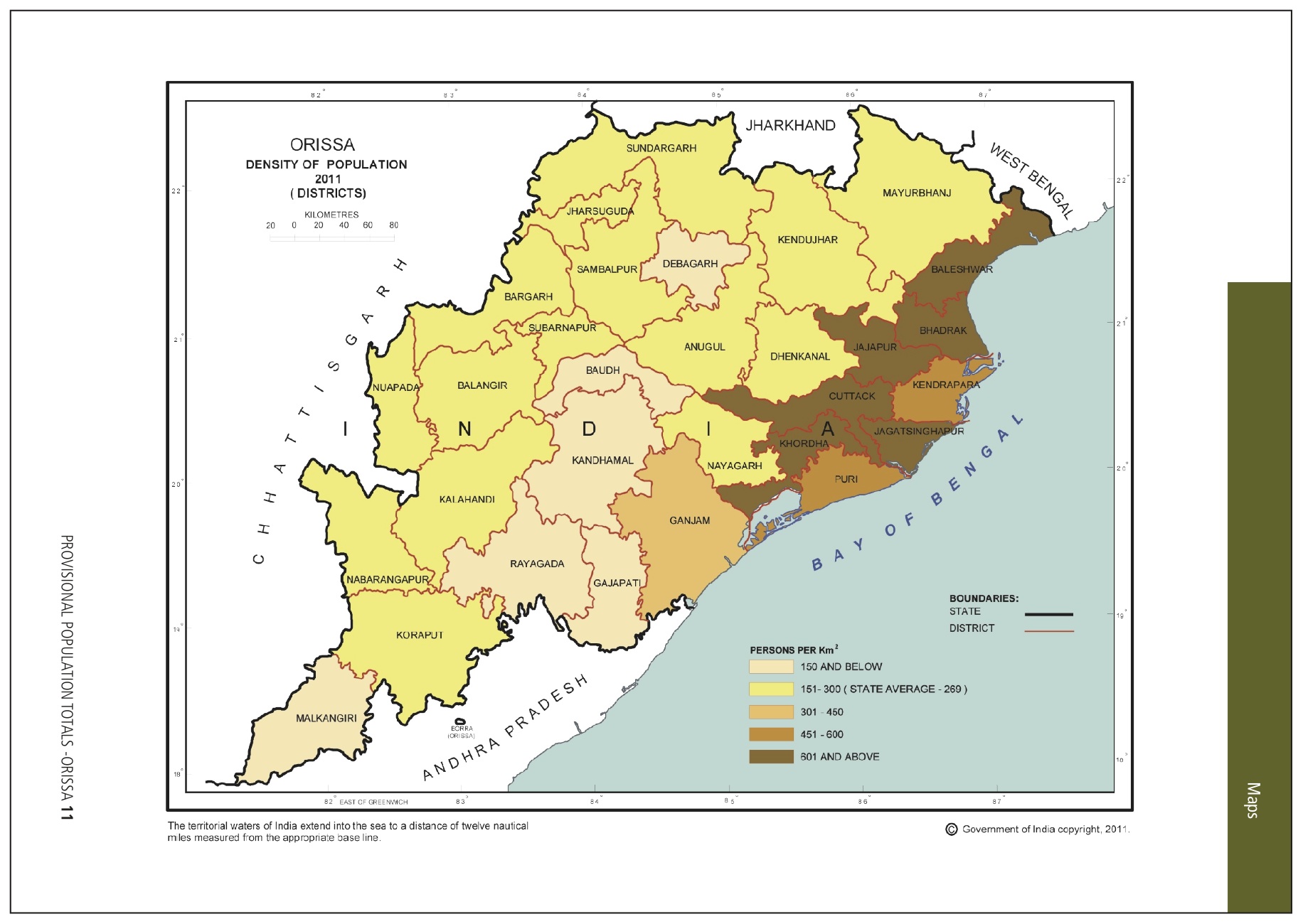
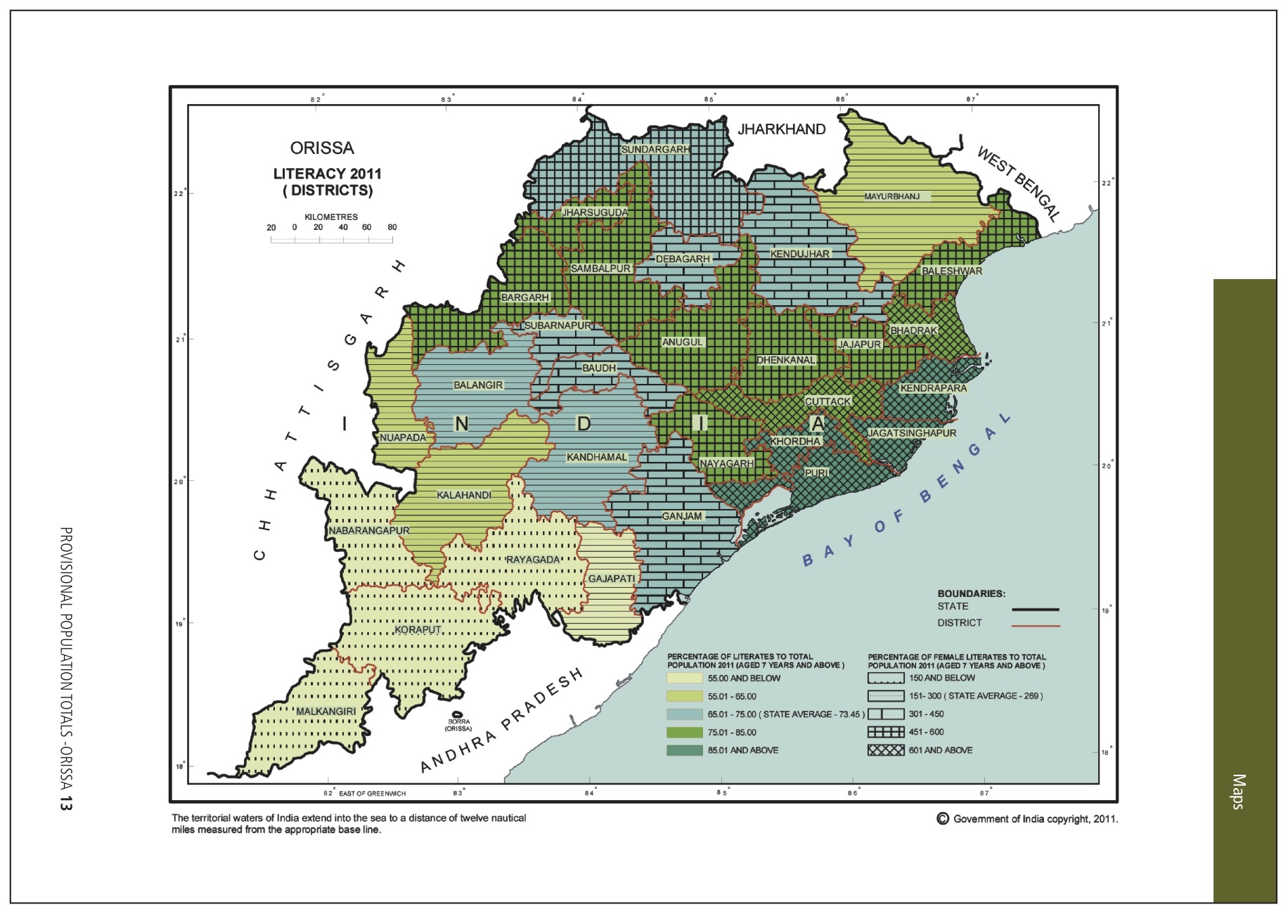
Odisha 2011 census highlights in maps

2011, Overall Odisha 3 Comments »

Following is from the Provisional Census Book 2011. The 40 MB file of that is here.

One interesting thing to note is that the location of the new Central University of Odisha in Koraput is right in the center of the 4 least literate districts of Odisha.

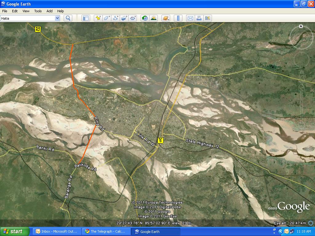
Bridge on Kathjodi near Trisulia would decrease the distance between Bhubaneswar and Cuttack by 10 km

Bhubaneswar and vicinity, Bhubaneswar- Cuttack- Puri, Bhubaneswar-Cuttack- Kalinganagar, Cuttack Comments Off on Bridge on Kathjodi near Trisulia would decrease the distance between Bhubaneswar and Cuttack by 10 km

Following are excerpts from a report in Telegraph.

The proposed bridge from CDA Square up to Trisulia and Baranga, which is said to be longest and first of its kind three-lane bridge in the state, would act as ‘direct-link’ between Cuttack and Bhubaneswar.

… “The distance between Cuttack and Bhubaneswar would be reduced by 10km after the completion of the project. Efforts are on by the government for the all-round development of Cuttack and I hope the new project would be completed on time,” Naveen said.

… With the construction of the second bridge, one would have to cover a distance of only 20km from CDA square to Jaydev Vihar via Nandankanan and Trisulia. The length of the bridge would be 2.8km and it would also have footpaths for pedestrians and cycles on both sides and dividers and railing. The cost of the total project was estimated to be around Rs 122crore.

… The project, to be built in assistance of National Bank of Agriculture and Rural Development (NABARD), is expected to be completed within three years.

The three-lane bridge would not only solve precious time of the people, it will also create new vistas for development in Barang and nearby areas which are also in an expansion mode. The project has been targeted to be completed within three years from the date of agreement with the company, Pradhan said.

… Apart from this, there is also a proposal to construct another bridge over Mahanadi river. The bridge would connect Pitapali area near Khurda with Dhenkanal on NH-5 via Manguli square. The existing route distance would be reduced to 71.5 km from 93km. The project is also likely to take off soon.

The last paragraph is confusing. Pitapali, Dhenkanal and Manguli Square form a triangle. It could mean the proposed bridge near Jatamundia in the following map.

Or, as suggested by reader Debi Prasanna Sarangi, it could mean the bridge over Mahanadi in the following map. (Note: The point where NH-5 meets NH-42 is called Manguli Square.)

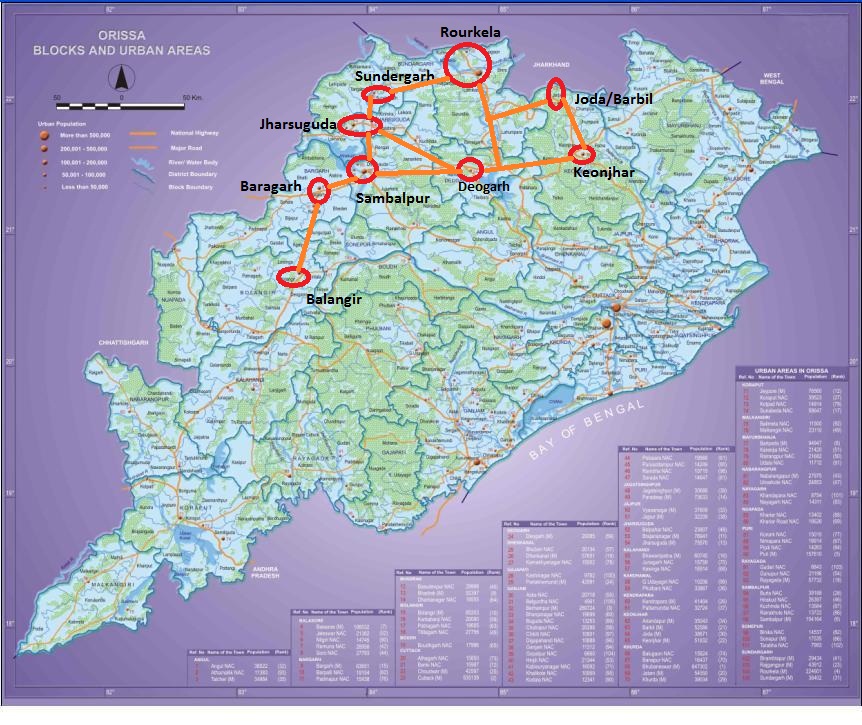
Development locations in the three regions of Odisha – in maps

Anugul- Talcher - Saranga- Nalconagar, Balasore- Chandipur, Baripada- Bangiriposi- Similipal foothills, Berhampur- Gopalpur- Chhatrapur, Bhubaneswar and vicinity, Bhubaneswar- Cuttack- Puri, Dhamara- Chandbali- Bhitarakanika, Jajpur Rd- Vyasanagar- Duburi- Kalinganagar, Jharsugurha- Brajarajnagar- Belpahar, Koraput- Jeypore- Sunabedha- Damanjodi, Overall Odisha, Paradip - Jatadhari - Kujanga, Rayagada- Therubali, Rourkela- Kansbahal, Sambaplur- Burla- Bargarh- Chipilima 1 Comment »

The Coastal Belt.

The Western Industrial Belt.

The Southwestern & Central Outposts.

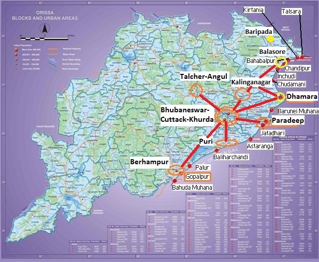
Envisioning the 150 km radius around Bhubaneswar in 20 years

Angul, Anugul- Talcher - Saranga- Nalconagar, Balasore, Balasore- Chandipur, Berhampur- Gopalpur- Chhatrapur, Bhadrakh, Bhubaneswar and vicinity, Bhubaneswar- Cuttack- Puri, Cuttack, Dhamara- Chandbali- Bhitarakanika, Dhenkanal, Ganjam, Jagatsinghpur, Jajpur, Jajpur Rd- Vyasanagar- Duburi- Kalinganagar, Khordha, Paradip - Jatadhari - Kujanga, Puri 5 Comments »

In 20 years (i.e., in 2030) the Bhubaneswar-Cuttack-Khurda population would be around 4 million plus. In addition the area would be surrounded by the following cities/towns within 150 kms radius (i.e., about a hour and half away).

  • Berhampur-Gopalpur to the south (with a then population of 1.5 million; about 145 kms away)
  • Puri to the south (with a then population of 700K; only 30kms away)
  • Kalinganagar to the North (with a then population of 500K; only 50 kms away)
  • Talcher-Angul to the West (with a then population of 500K; only 110 kms away)
  • Dhenkanal to the west (with a then population of 200K and almost in the periphery)
  • Paradip to the east (with a then population of 400K and 90 kms away)
  • Dhamara-Chandbali to the Northeast (with a then population of 200K and 140 kms away)
  • Bhadrak to the North (with a then population of 200K and 140 kms away)

A little farther is

  • Balasore-Chandipur to the North (with a then population of 300K and 162 kms away from the Northern end of Bhubaneswar-Cuttack-Khurda area)

In addition there will be several port towns other than the ones mentioned above and a few smaller towns (For example, Nayagarh)  within 200km radius of greater Bhubaneswar.

Besides individual CDPs for these areas the Odisha governement should start making plans for this larger overall area. It would form a different kind of megalopolis than New Delhi, Mumbai or Kolkata with a well planned hub (Bhubaneswar) surrounded by mini-hubs and with rural areas in between. I can not off-hand think of another such area in the world; may be the readers can point me to some. Please suggest what kind of plans need to be made. (Please note that for something to be up and running in 20 years, plans need to be made now.) For example:

  • Commuter trains at frequent intervals and the necessary infrastructure for that. Following are some of the segments
    • Bhubaneswar-Puri-Konark-Astaranga (Puri-Konark-Astaranga needs to be built; alternatively if Astaranga port comes up, then there may be a new line from Barang to Astaranga)
    • Bhubaneswar-Berhampur-Gopalpur (Berhampur-Gopalpur needs to be built)
    • Bhubaneswar-Jajpur Rd(Kalinganagar)-Bhadrak-Dhamara (Bhadrak-Dhamara is ready but no trains yet)
    • Bhubaneswar-Jajpur Rd(Kalinganagar)-Bhadrak-Balasore-Baripada
    • Bhubaneswar-Jakhapura(Kalinganagar)-Tomka (on the line to Kendujhargarh)
    • Bhubaneswar-Cuttack-Paradeep (ready)
    • Bhubaneswar-Dhenkanal-Talcher-Angul (ready)
    • Bhubaneswar-Khurda-Nayagarh and beyond (being constructed; part of Khurda-Balangir)
    • Angul-Talcher-Sukinda-Kalinganagar (being constructed)
  • Expressways linking these places
  • Fast buses linking these places
  • Fast airport shuttle
  • Some of these places would be connected by waterways including National Waterway 5
  • Express ring road around each of these places
  • Co-ordinated public transport in each of these places
  • ??

Please let your imagination run wild!

Cuttack people unhappy with trains bypassing Cuttack: An easy solution

Bhubaneswar and vicinity, Bhubaneswar- Cuttack- Puri, Cuttack, ECOR, Khordha, Railway maps 1 Comment »

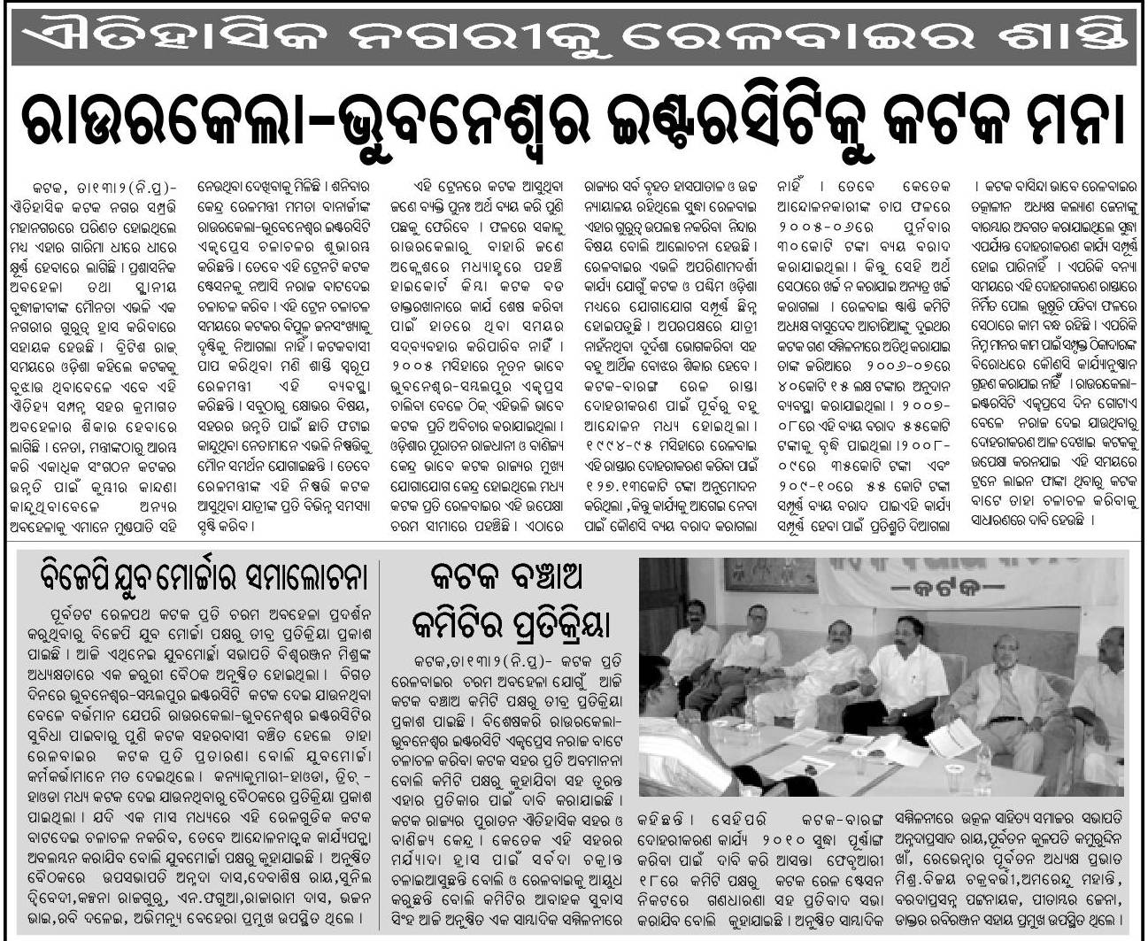
Recently unhappiness is brewing because of various trains bypassing Cuttack. See the following news item from Samaja.

I believe there is a easy solution to this: Develop the Naraj station to have express train stops and develop the accessibility of the Naraj station from the roads that goes from Naraj to Bidanasi side of Cuttack.

I wrote about it earlier in http://www.orissalinks.com/orissagrowth/archives/1967. Following are some excerpts from that article.

Naraj Station lies across Kathjodi river about 1 km away from the bridge. It is about 2 kms from the proposed 2nd campus of Ravenshaw university, 3-4 km from Bidanasi-CDA and within 1 km from the proposed Sri Sri University. 

Several trains in the BBS (Bhubaneswar)-SBP (Sambalpur) line such as 2893 (BBS-BLGR superfast), 8304 (Puri-SBP Intercity), 8405 (Puri-ADI), 8507 (VSK-ASR) skip Cuttack and go via Naraj without stopping there. By developing the Naraj station a bit more, developing the road between the station and the bridge, and introducing stops at Naraj station people in Cuttack will be able to easily access these trains.

… Naraj is really very close to Cuttack; much close to Cuttack than Barang or the proposed station between Barang and Patia. Also, Naraj station is much closer to the newer parts of Cuttack (such as CDA and Bidanasi) than the Cuttack station. Also, a lot of development is planned near Naraj that includes the Sri Sri University, National Law University and 2nd campus of Ravenshaw University. …

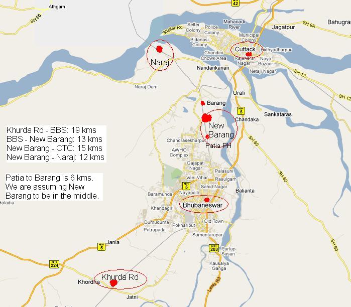
There were some concerns regarding the overlap with the proposed New Barang station between Patia and Bhubaneswar. I think with the rate Cuttack-Bhubaneswar area is growing even if a major station in the form of a New Barang station comes up, it will be still a good idea to have a express stop station in Naraj.

In the not too far future the greater Bhubaneswar area would need five stations: Khurda Rd, Bhubaneswar, New Barang, Cuttack and Naraj. The following map shows the five stations and the distance between them.


558 Kms of single lane highways in Orissa to be two laned funded by a world bank loan

Overall Odisha, Road maps, Roads, highways and Bus stands, World Bank 1 Comment »

Following is an excerpt from a report in Times of India.

The road, transport and highways ministry (MoRTH), which has sought a $3 billion loan from the World Bank for this project, has already finalized 3,769 km to be taken up for double laning. The ministry has also identified another 2,600 km for this purpose.

Seven stretches covering 807 km of single-lane highways would be doubled in Bihar while nearly 638 km of single-lane NH falling in Himachal Pradesh would be upgraded. Orissa and Uttarakhand will see 558 km and 448 km of similar stretches being upgraded.

Sources said the preliminary report prepared by the ministry for other stretches shows that HP would get a good share in the list of states to be covered under the plan. Similarly, Uttarakhand, Bihar and Orissa will see large stretches being double-laned.

I could not find out which highways in Orissa are part of this. Some of the sites to watch for are:

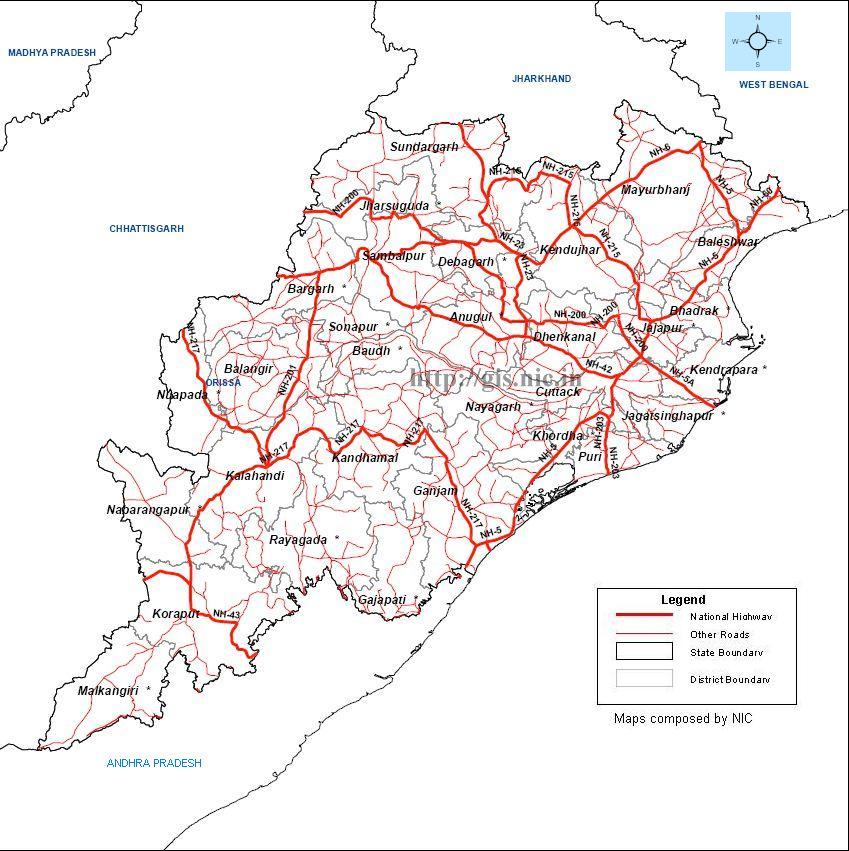
Following is a map of the National Highways in Orissa obtained from the Ministry of Road and Transport’s website.

Existing, Under Construction and planned ports of Orissa

Astaranga, Puri (Navayuga interested), Bahabalpur, Balasore (unlikely), Bahuda Muhana, Ganjam (many interested), Balasore, Baliharchandi, Puri (many interested), Barunei, Kendrapada (many interested), Bhadrakh, Chandbali, Chandipur, Balasore (Unlikely), Choumukha-Kirtania, Balasore (Creative ports, Chennai interested), Chudamani, Bhadrakh (Birlas interested), Dhamara port (under constr.), Ganjam, Gopalpur port (under constr.), Inchudi, Balasore (many interested), Jagatsinghpur, Jatadhari port (POSCO), Kendrapada, Overall Odisha, Palur, Ganjam (Future metals interested), Paradeep port, Puri, Talsari (Bichitrapur) - JSW interested 1 Comment »

Update:Tathya has a recent report on who is pursuing which port. Following is a table based on that info.

Port Company Interest in it
Talsari (Bichitrapur) JSW interested.
Kirtania (Subarnarekha mouth) Creative Ports signed MOU.
Bahabalpur DOD approval needed.  ???
Chandipur Defense Department objects.???
Inchudi IL&FS interested.
Chudamani Aditya Birla Group signed MOU.
Dhamara Tata Steel, L & T JV
Barunei Muhana Arcelor Mittal; Adhunik Metallics; SPI ports; Sical logistics; Mundra ports.
Paradeep Exists. PPL
Jatadhari Posco
Astaranga Navayuga group signed MOU. Shipyard proposed.
Baliharchandi Shyam group interested.
Palur Future metals; shipyard proposed.
Gopalpur OSL; shipyard proposed.
Bahuda Muhana (Sonapatipur) shipyard proposed. ???


Getting to the Gandhamardan Hills

Balangir, Bargarh, Gandhamardan Hill Range (needs to be made), Hills and hill stations, Nuapada, Railway maps, Road maps 2 Comments »

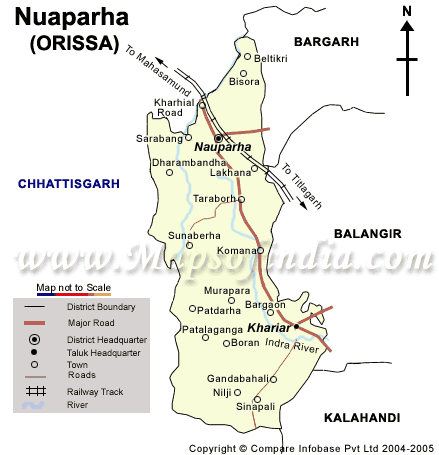
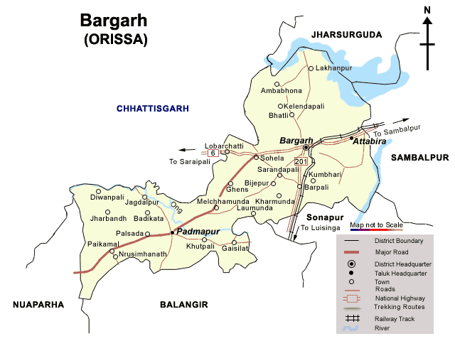
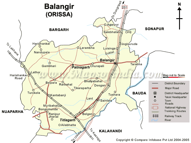
The two main access point to this hill is the Nrushinghanath Temple (Baragarh district) in the North side and the Harishankar temple and falls (Balangir district) in the south side. The road distance between the two is 40 kms and one can walk on the mountain top between these two places through a day long 16 km hike. The following three maps show these areas.

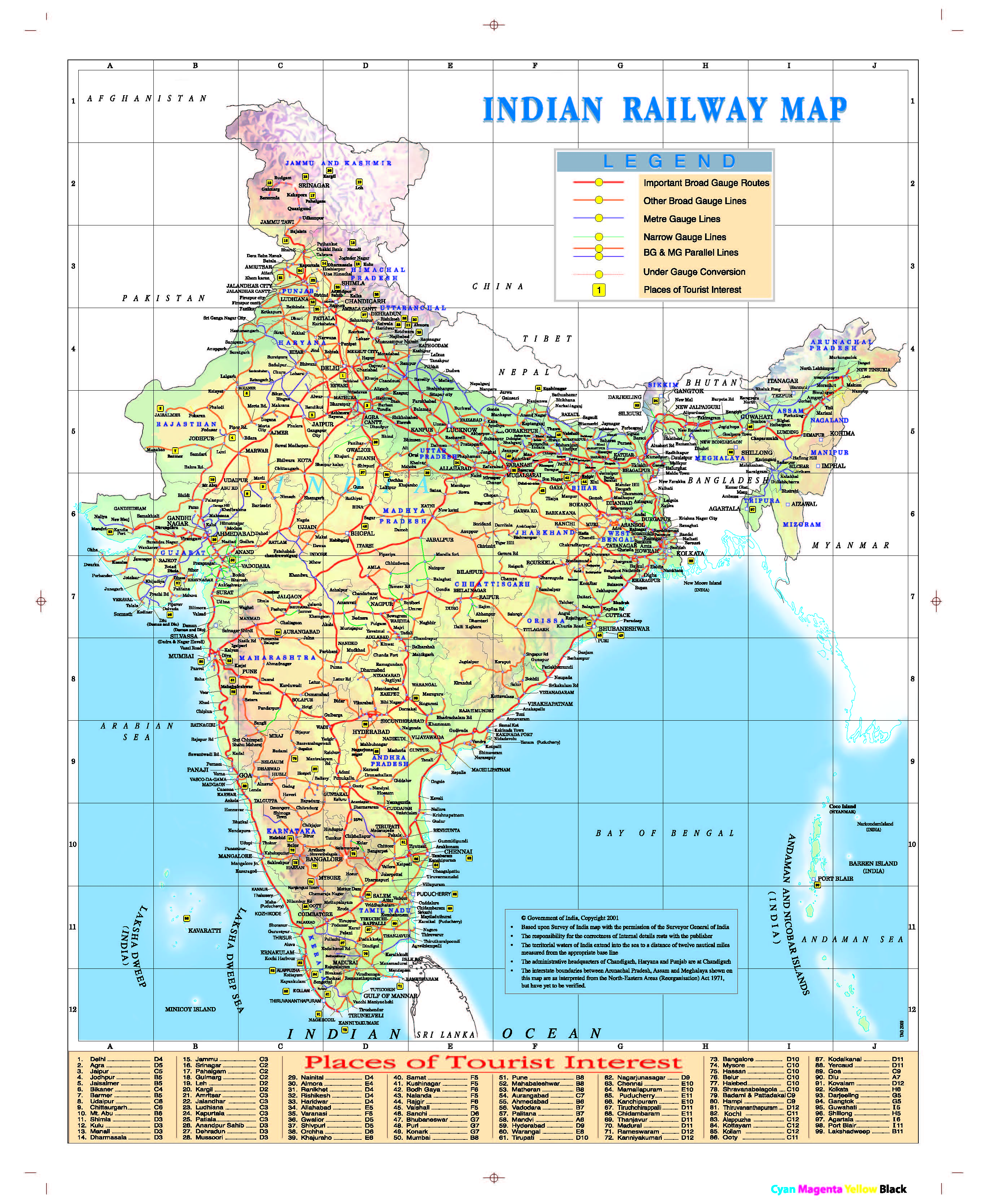
The Indian Railways Map from the new November 2009 TAG (Train at a Glance)

India map, Railway maps, Time table and websites Comments Off on The Indian Railways Map from the new November 2009 TAG (Train at a Glance)

The following is from http://www.indianrailways.gov.in/TAG0910/Index.htm.

Aditya Birla group signs MOU to build a port in Chudamani, Bhadrak

Bhadrakh, Birlas, Chudamani, Bhadrakh (Birlas interested), TOI, Economic Times, Wikimapia maps Comments Off on Aditya Birla group signs MOU to build a port in Chudamani, Bhadrak

Following is an excerpt from a report in Economic Times by Nageshwar Patnaik.

The Aditya Birla group on Thursday signed a MoU with Orissa government to develop a sea port on Build Own Operate [BOO] basis at Chudamani in Bhadrak district on an investment of Rs.1,500 crore.

The projected capacity of the port to be developed over four years will be three million tons per annum [MTPA] in the first phase. This will be expanded subsequently to 10 mtpa.

The port will have two berths, and will handle bulk cargo such as cement, aluminium, iron ore, thermal coal, limestone, gypsum, clinker and copper. The port will be connected by a rail corridor from Markona Station to port site.

  … "In this port, directly or indirectly, about 5,000 people will be employed. By operation of the port, the state government will get revenue about Rs.20 crore per annum."

Mr Patanik hoped that the port promoter would work with the district administration and other agencies to plan and develop a port-based industrial township. …

Speaking on the occasion, Aditya Birla group executive president, Ravi Kastia said, "… We are confident that the Aditya Birla Group’s experience in putting up as many as six port facilities in the Western Coast, backed by the unstinting support of the Government of Orissa, will help us create a much required port in the state."

Proposed road network in the Bhubaneswar development plan area

Bhubaneswar and vicinity, Bhubaneswar- Cuttack- Puri, Khordha, NH 5 (488 kms: NH No.6 in Jharkhand - Baripada - Baleshwar - Bhadrakh - Cuttack - Bhubaneswar - Khordha - Brahmapur - upto Andhra Pradesh Border), Road maps, Roads, highways and Bus stands 2 Comments »

Population of Bhubaneswar – Cuttack urban complex is 1.9 million in 2008

Bhubaneswar and vicinity, Bhubaneswar- Cuttack- Puri, Cuttack, Khordha, Masterplans & CDPs 2 Comments »

As per this page in the document prepared by IIT Kharagpur the population of the above complex in 2008 is 1.9 million.

Indian Railways exploitation of backward and tribal areas of Orissa: confronting Railway Board Chair with the facts in Toronto

Balasore - Niligiri (defunct?), Baripada - Bangiriposi (under constr.), EXPOSING ANTI-ODISHA-GROWTH SCHEMES, FINANCE & BANKING, Gajapati, Ganjam, Interstate disputes on Water and rivers, Jaroli - Deojhar .. Chaibasa, Kandhamala, KBK Plus district cluster, Keonjhar, Koraput - Rayagada, Mayurbhanj, Nayagarha, Odisha Consumer Welfare Foundation, Paradip - Jatadhari - Kujanga, Railway maps, Rajathagara - Nergundi, Rayagada, Samaja (in Odia), Sambalpur, Sonepur, Sundergarh, Talcher - Barang, Titlagarh - Jharsugurha Jn, Tomka - Jaroli, Uncategorized 3 Comments »

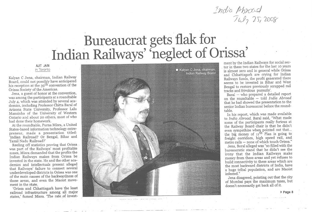
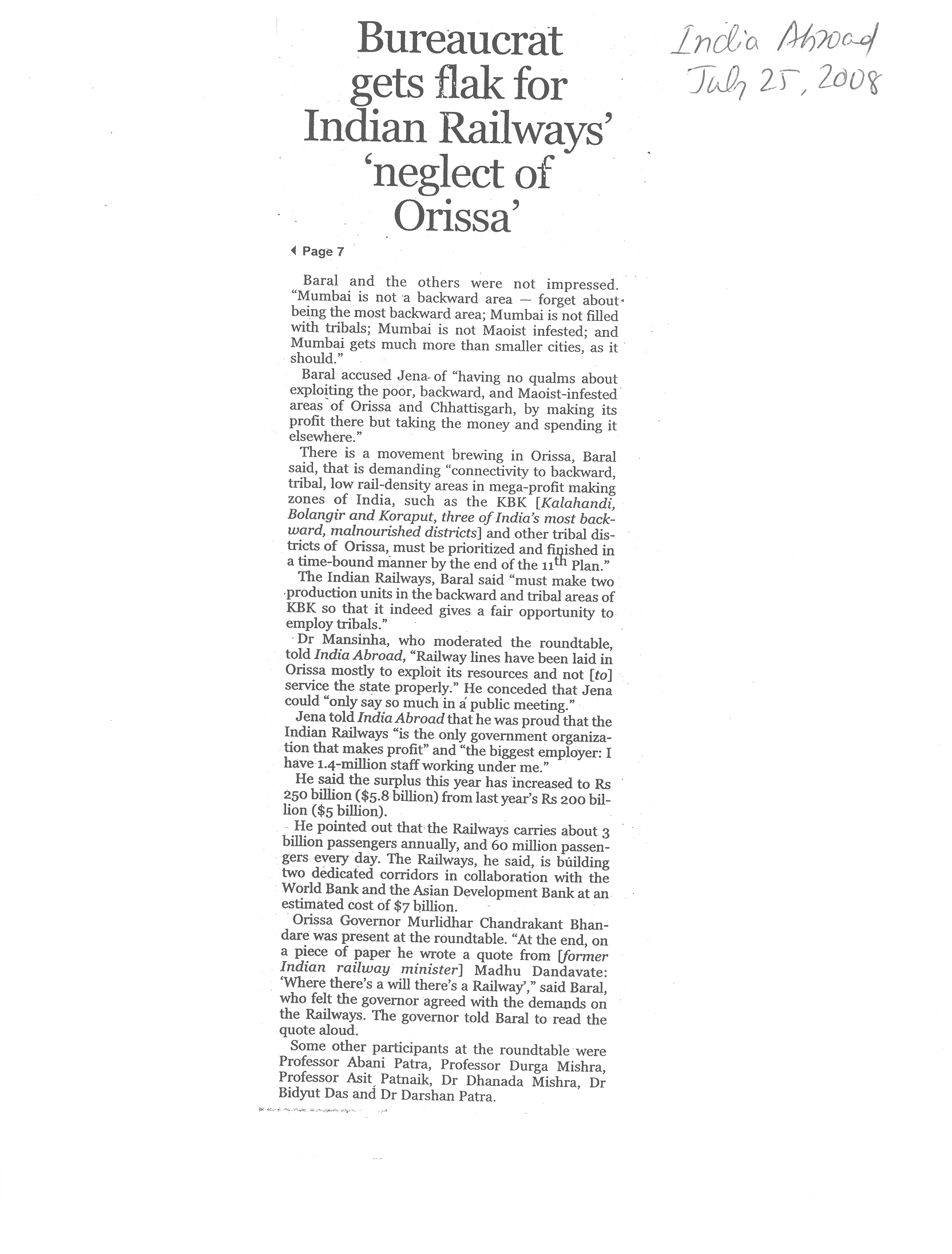
Following is the news report on the discussion (almost a confrontation) with the Railway Board Chair, as reported in India Abroad. The basic premise behind our grievances against Indian Railways and our demands is simple.

  • Indian railways is scheduled to make 2500-3000 crores/year from Orissa, but spends only 1000 crores/year on Orissa in terms of new lines, doubling and gauge conversion.
  • Its current plan for major spending includes freight corridors, metro rails, and high speed rails, none of which touch Orissa. It plans to do gauge conversion of 12000 kms, most of which is unprofitable (this proves that Indian Railway lies when it says it only does profitable lines), very little (less than 100 km) of which is in Orissa.
  • Orissa is already behind the national average in terms of rail density and way behind its neighbors such as West Bengal and Bihar. If no changes are made to the 11th plan IR allocations Orissa will further fall behind.
  • Indian Railways must not take money from its profit in Orissa, and spend it else where, until it takes care of proper connectivity to Orissa’s tribal, backward and maoist infested areas. The 2500-3000 times 5 = 12,500 -15,000 crore that Indian Railways will profit from Orissa during the 11th plan must be spend in new lines in Orissa until the (i)-(v) lines below and other port and mine connectivity lines are completed during the 11th plan.
  • To Mr. Jena’s retort that Mumbai earns so much in taxes and not all of it is spent in Mumbai; we reply that it is often acceptable to take from rich and give to poor; But when did it become acceptable to take from poor (Orissa) and give to rich (freight corridors etc. in other states)?

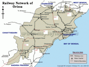
The lines in Orissa connecting to the tribal and backward areas that we demand to be finished during the 11th plan are:

  • (i) Khurda Rd – Nayagarh – Balangir: Lack of connectivity was one of the reasons a recent Maoist mayhem happened in Nayagarh. It seems after recent events, including the confrontation with the Railway Board Chair and various dharanas in Bhubaneswar, IR has started responding to this demand, but not to the extent to promise its completion during the 11th plan. Note that Balangir is the B in the KBK districts that are the most backward in India.
  • (ii) Lanjigarh Rd – Junagarh – Nabarangpur – Jeypore – Malkangiri – Bhadrachalam Rd in Andhra Pradesh: Only small part of this is approved. Most of it is not even surveyed. In the long run this will really bring those parts of Orissa closer to the rest of Orissa. This is the most important connection and has to be take care of at the earliest. Like the approved Vijaywada-Ranchi highway, this line will create an alternative Hyderabad – Ranchi path passing through backward and tribal areas of Andhra Pradesh, Orissa and Jharkhand. This line will connect the Kalahandi and Koraput districts, the two K’s in KBK. The recent Maoist attack and killing of the Greyhound forces in Malkangiri might have been prevented if this line existed as then the forces would have used the train rather than being seating ducks taking a boat across a lake in Malkangiri.
  • (iii a) Rayagada – Gopalpur: This has been surveyed and but work on it has not started. Note that Rayagada is part of the undivided Koraput district, one of the K’s of KBK. This line could come under port connectivity and will be a viable line connecting the industries near Rayagada with the upcoming port in Gopalpur.
  • (iii b) Gunupur – Theruvali: This will add to the Naupada-Gunupur line and make it an economically viable line. (IR and Mr. Jena agree about its importance.) This line will be completely inside the Raygada district, part of the undivided Koraput district, one of the K’s of KBK.
  • (iv) Talcher – Bimlagarh (connectivity to the tribal district of Sundergarh): This line has been approved but is only being given a few crores each year, which is less than the inflation. This line will reduce the distance between Sundergarh district and teh coastal areas significantly. For example, it will make Rourkela only 4-5 hrs from Bhubaneswar.
  • (v) Baripada/Buramara – Chakulia: This line will connect the tribal district of Mayurbhanj to tribal areas of Jharkhand. It will add to the Rupsa-Baripada-Bangiriposi line and make it an economically viable line. (IR and Mr. Jena agree about its importance.)

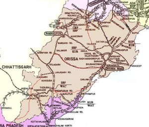
All these lines can be completed if Indian railways just suspends its practice of taking from poor (Orissa) and giving to the rich for only a few years (may be just 3-4 years). The following maps show the above mentioned lines.

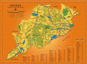
Orissa map showing tourist destinations

Overall Odisha Comments Off on Orissa map showing tourist destinations

The map was obtained from the Team Orissa web site.

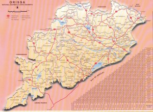
National Highways and State Highways in Orissa: a map

Overall Odisha, Road maps 2 Comments »

The map was obtained from the Team Orissa web site.

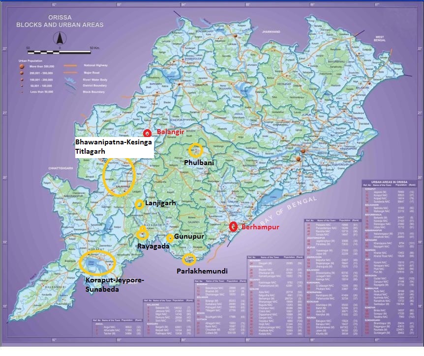
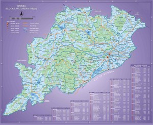
Orissa map: Urban areas and blocks of Orissa

Overall Odisha 4 Comments »

This map was obtained from the Team Orissa web site.

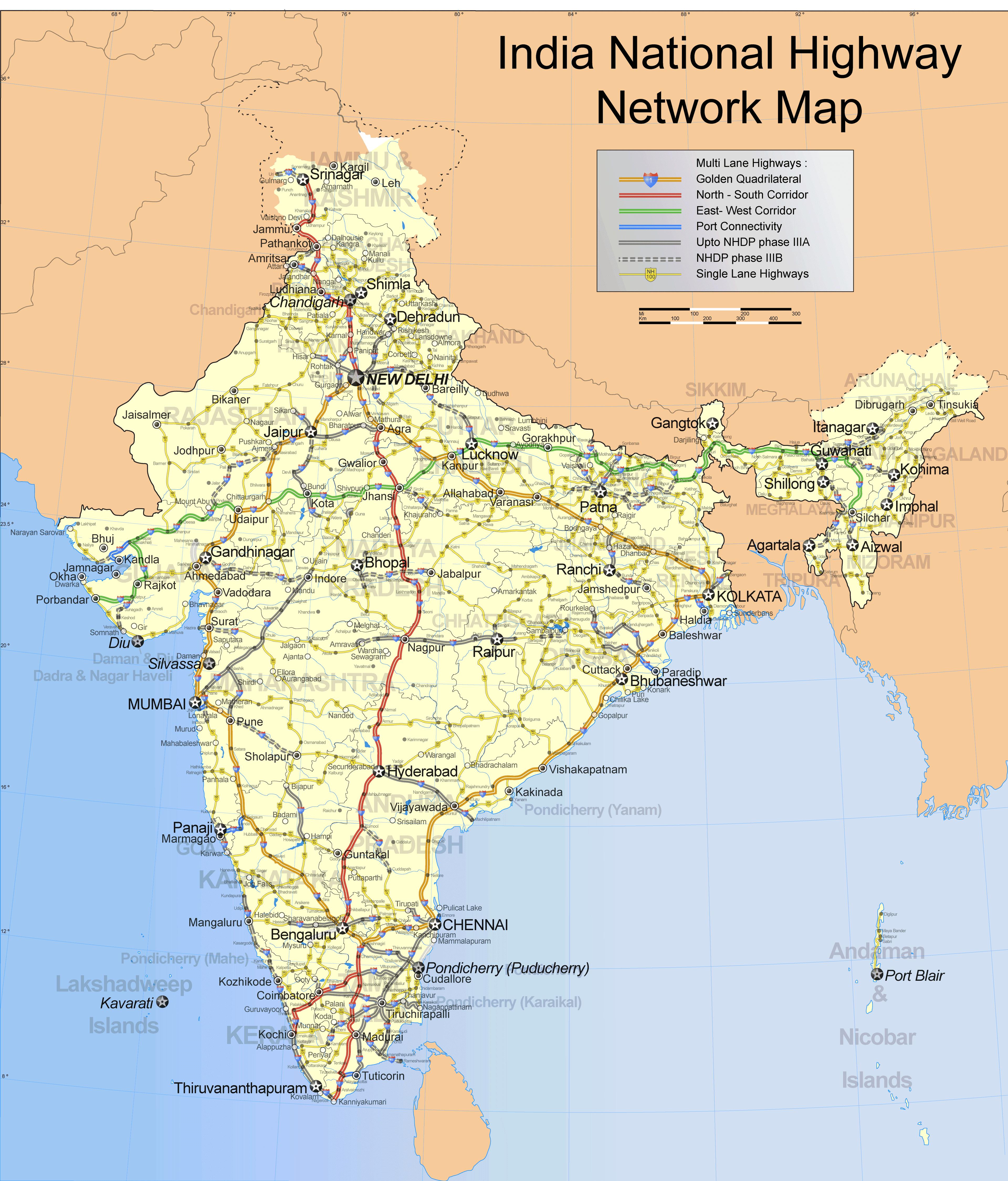
National Highway map in jpg: converted from the map in wikipedia

India map, Overall Odisha, Road maps, Roads, highways and Bus stands Comments Off on National Highway map in jpg: converted from the map in wikipedia

Universities and university level Institutes in the greater Bhubaneswar area: existing and upcoming

Bhubaneswar and vicinity, Bhubaneswar- Cuttack- Puri, Khordha, Marquee Institutions: existing and upcoming, Puri, Universities: existing and upcoming, Wikimapia maps Comments Off on Universities and university level Institutes in the greater Bhubaneswar area: existing and upcoming


Forest resource of Orissa

India map, Odisha forests, Overall Odisha, THINGS ODISHA N ODIA, Websites of Interest Comments Off on Forest resource of Orissa

The following is from http://envfor.nic.in/fsi/sfr99/sfr.html. The maps below are also copied from there. Both talk about the status in 1999. More info on Orissa forests is at http://www.orissafdc.com/.

India:

The recorded forest area of the country, as reported by the state forest departments, is 76.52 million ha which constitutes 23.28 per cent of the total geographical area of the country.

Orissa:

The recorded forest area is 5.72 million ha, which constitutes 36.73% of the geographic area of the state. The forests are uniformly distributed in the state except in coastal districts where they are scarce. By legal status, the Reserved Forest constitutes 47.37%, Protected Forest 52.60% and Unclassed Forest 0.03%. About 0.503 million ha, constituting 8.8% of total forest area, is affected by shifting cultivation.    

There are four forest types namely Tropical Semi Evergreen, Tropical Moist Deciduous, Tropical Dry Deciduous, and Littoral and Swamp Forests.