Archive for the 'NH 217 (438 Kms: Chhattisgarh Border – Khariar Rd – Nuapada – Khariar – Titlagarh – Ramapur – Baligurha – Asika – Brahmapur – Gopalpur)' Category
Orissa seeks long term solution for Kandhamala problem: Hindu
Kandhamala, NH 217 (438 Kms: Chhattisgarh Border - Khariar Rd - Nuapada - Khariar - Titlagarh - Ramapur - Baligurha - Asika - Brahmapur - Gopalpur), Odisha govt. action 1 Comment »Following is an from a PTI report in Hindu.
Orissa government has asked the Centre to adopt a long term plan for Kandhamal, prone to ethno-communal violence instead of seeking any quick solution, official sources said on Tuesday.
Orissa’s suggestion came after the high-level central team headed by Union Agriculture Minister Sharad Pawar, which visited Kandhamal today, sought to know what assistance was needed in mitigating the problems there.
"The Centre wants to support Orissa in building confidence among all sections of the people in Kandhamal," Pawar told reporters after the team arrived here yesterday.
Identifying backwardness in education, lack of connectivity and poor livelihood means as the cause behind the ethno-communal violence in Kandhamal, Orissa government asked the Centre to set up a campus of the National Tribal University, Amarkantak at Phulbani, the district headquarter town.
"As scheduled tribes constitute 52 per cent of Kandhamal’s population, it is proposed to have one Ekalavya model residential school (EMRS) in each block to cater to the needs of tribal children," a report sbubmitted to the central team by the state government said.
This apart, the state government also asked for at least six schedule caste hostels to cater the children of SCs who comprise 17 per cent of the total population in the district .
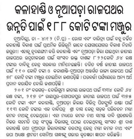
Stating that connectivity was the main obstacle for the administration proper deployment of security force, it said NH 217 which passed through Kandhamal need to be double laned.
Roads and Highways infrastructure in Orissa
Angul, Balangir, Balasore, Bargarh, Baripada-Balasore-Kirtania, Bhadrakh, Bhadrakh-Balasore, Bhadrakh-Dhamara, Bhubaneswar-Berhampur, Bhubaneswar-Cuttack- Kalinganagar, Bhubaneswar-Dhenkanal- Anugul, Bhubaneswar-Nayagarh, Bhubaneswar-Paradip, Bhubaneswar-Pipli- Astaranga, Bhubaneswar-Pipli- Konark, Bhubaneswar-Puri, Bouda, Choudwar-Kendrapara - Dhamara, Coastal highway, Corridors emanating from Bhubaneswar metro, Cuttack, Cuttack-Paradip, Deogarh, Dhenkanal, DISTRICTS & BLOCKS, Gajapati, Ganjam, Grama sadak, Jagatsinghpur, Jajpur, Jharsuguda-Sambalpur- Bargarh, Jharsugurha, Kalahandi, Kalinganagar - Kamkhya Nagar - Talcher, Kalinganagar - Panikoili - Jajpur - Kendrapara, Kalinganagar - Tarini - Keonjhar, Kalinganagar- Chandikhol- Paradip, Kalinganagar-Bhadrakh, Kandhamala, Kendrapada, Keonjhar, Khordha, Koraput, Malkangiri, Mayurbhanj, Mining Corridor, Nabarangpur, National Highways, Nayagarha, NH 200 (440 Kms: Chhattisgarh - Jharsuguda - Deogarh - Talcher - Kamakhyanagar - Duburi - Chandhikhol), NH 201 (310 Kms: Boriguma - Bhawanipatna - Balangir - Bargarh), NH 203 (97 Kms: Bhubaneshwar-Pipili-Puri-Konark), NH 203A (49 Kms: Puri - Bramhagiri - Satpada), NH 215 (348 Kms: NH-5@Panikoli - Anandapur - Kendujhargarh -Rajamundra @NH-23), NH 217 (438 Kms: Chhattisgarh Border - Khariar Rd - Nuapada - Khariar - Titlagarh - Ramapur - Baligurha - Asika - Brahmapur - Gopalpur), NH 224 (298 Kms: Khordha - Nayagarh - Dashapalla - Bauda - Sonapur - Balangir), NH 23 (209 Kms: Jharkhand Border - Rourkela - Rajamundra - Pala Laharha - Talcher - NH-42), NH 42 (261 Kms: NH-6@Sambalpur - Redhakhol - Anugul - Dhenkanal - NH-5@Nergundi), NH 43 (152 Kms: Chhattisgarh Border - Chandili - Borigma - Jaypur - Koraput - Sunki - Andhra Pradesh Border), NH 5 (488 kms: NH No.6 in Jharkhand - Baripada - Baleshwar - Bhadrakh - Cuttack - Bhubaneswar - Khordha - Brahmapur - upto Andhra Pradesh Border), NH 5A (77 Kms: NH-5 at Chandikhol to Paradip), NH 6 (462 Kms: Chhattisgarh Border - Lobarchatti - Bargarh - Sambalpur - Deogarh - Kendujhargarh - Jashipur - Bangriposi - Jharkhand Border ), NH 60 (57 Kms: West Bengal Border- Jaleswar - Baleshwar), NH 75 (18 Kms: Jharkhand Border to NH-215 near Parsora), Nuapada, Overall Odisha, Puri, Puri - Konark, Rayagada, Road maps, Roads, highways and Bus stands, Rourkela-Jharsuguda, Sambalpur, Sonepur, State highways, Sundergarh, Vijaywada-Ranchi highway Comments Off on Roads and Highways infrastructure in Orissa
In recent years there has been a big jump in the number of kilometers of national highways in Orissa. Following is copied from my page "Roads and Highways infrastructure in Orissa."
Road network: Orissa Roads1; Orissa Roads2; India’s NH network; India’s golden quadrilateral; the part of the GQ/NH-5 that runs through Orissa.
- National Highways in Orissa and India; its growth in recent years:
- NH 5: Junction with NH No.6 in Jharkhand near Baharagora-Baripada–Baleshwar-Bhadrakh-Cuttack- Bhubaneswar-Khordha-Chhatrapur-Brahmapur– upto Andhra Pradesh Border. (488 kms)
- NH 5A: Junction with NH No.5 near Haridaspur-Paradip Port. (77 kms)
- NH 6: From Chhattisgarh Border-Lobarchatti- Bargarh – Sambalpur-Deogarh-Barakot- Kendujhargarh -Jashipur-Bangriposi-upto Jharkhand Border (462 kms)
- NH 23: From Jharkhand Border-Panposh-Raurkela– Rajamundra-Barakot- Pala Laharha-Talcher-Jn. with NH-42 (209 kms)
- NH 42: Junction with NH No.6 near Sambalpur– Redhakhol-Anugul-Dhenkanal- Jn. with NH-5 near Cuttack. (261 kms)
- NH 43: From Chhattisgarh Border– Dhanpunji- Borigma- Jaypur–Koraput-Sunki- Andhra Pradesh Border. (152 kms)
- NH 60: From West Bengal Border– Jaleswar – Baleshwar (57 kms)
- NH 75: From Jharkhand Border to junction with NH No.215 near Parsora (18 kms)
- NH 200: From Chhattisgarh-Machida-Jharsuguda– Kochinda- Deogarh –Talcher-Kamakhyanagar-Sukinda- Chandhikhol (440 kms)
- NH 201: Boriguma-Ampani-Bhawanipatna– Belgan- Balangir-Luisinga-Jogisuruda-Dunguripali-Bargarh (310 kms)
- NH 203: Bhubaneshwar-Pipili-Puri–Konark (97 kms)
- NH 203A: The highway starting from its junction with NH-203 at Puri, connecting Bramhagiri and terminating at Satpada (49 kms)
- NH 215: Panikoli-Anandapur-Ghatgan- Kendujhargarh– Parsora-Koira-Rajamundra (348 kms)
- NH 217: From Chhattisgarh Border-Nauparha-Khariar- Titlagarh-Belgan- Ramapur- Baligurha-Sorada-Asika- Brahmapur– Narendrapur- Gopalpur (438 kms)
- NH 224: Khordha-Nayagarh-Dashapalla- Purunakatak-Bauda-Sonapur-Balangir (298 kms)
- Vijaywada-Ranchi highway (approved by planning commission as reported in May 2006), [July 06] [The Orissa government has been demanding a NH from Vijaywada to Ranchi which will pass through the Naxal infested areas. 1200 km of this 2000km will be in Orissa. CM talked to planning comission about it.]
- Ongoing National Highway work in Orissa
- Future plans for Orissa: [1:april-28-05]; [2:april-28-05].
- Various phases of NHDP: [1]; [2]; [3]
- Other highway plans:
- 4 laning of Chandikhol-Paradip by February-end of 2007
- 4 laning of Keonjhar-Panikoili, Duburi-Talcher, Cuttack-Paradeep and Duburi-Keonjhar Highways. [June17-05-Pragativadi]
- Aim-for-with-high-priority/parts-of-it-in-Orissa-govt- plan(page4)-already:
- Connect NH 215 (perhaps at Jajpur Rd) to Jenapur to NH200 (where it meets Brahmani) with a highway as Jenapur is the location where the National waterway will cross the railway line and Jenapur is 7 kms from where a branch of the line goes to Daitari and Bansapani.
- Designate AP-border-Koraput-Raygada-Padampur- Berhampur (in NH5) as a National highway. (This will bring Koraput and Raygada, thus a big part of KBK, closer to BBSR) — a slight revision of what is in the plan
- Designate Anandpur (NH 215)-Bhadrak-Dhamara port as an NH. (This will bring Dhamara port closer to Jharkhand, thus helping industries in Jharkhand and Orissa.)
- Jagatpur-Kendrapara-Chandbali-Dhamara — make it an NH (alternative route to Dhamara port)
- Panikoili/Kuakhia-Jajpur-Aradi-Chandabali — make it an NH (alternative route to Dhamara port)
- Panikoili-Jajpur-Kendrapara-NH5a-Paradeep — make it an NH (alternative to Paradeep port)
- Orissa State Road Transport Company (OSRTC)
- Wide city roads:
- Bhubaneswar area road plans:
- Being pursued: BBSR-Barang-Khuntuni-NH42; alternate route to Bhubaneswar-Cuttack via Barang; Khurda-Cuttack bypass via Pitapalli; Bhubaneswar (Uttara chhack) to Paradeep highway (Uttara chhack map)
- Should be pursued: Bhubaneswar-Khurda Rd station (already some Puri-Adi trains bypass Bhubaneswar. So Khurda Rd could be an alternative reliever station for Bhubaneswar. Then this road would be very important.); Patia station to Pahala in NH5 (this would be a third alternative to Bhubaneswar-Cuttack especially from the hot area of KIIT, Infocity, etc.)