Archive for the 'State highways' Category

NHDP (National Highways Development Project) and Odisha

Bhubaneswar - Paradeep, Capital Region Ring Road (CRRR), Coastal highway, NH 203 (97 Kms: Bhubaneshwar-Pipili-Puri-Konark), NH 215 (348 Kms: NH-5@Panikoli - Anandapur - Kendujhargarh -Rajamundra @NH-23), NH 23 (209 Kms: Jharkhand Border - Rourkela - Rajamundra - Pala Laharha - Talcher - NH-42), NH 42 (261 Kms: NH-6@Sambalpur - Redhakhol - Anugul - Dhenkanal - NH-5@Nergundi), NH 5 (488 kms: NH No.6 in Jharkhand - Baripada - Baleshwar - Bhadrakh - Cuttack - Bhubaneswar - Khordha - Brahmapur - upto Andhra Pradesh Border), NH 5A (77 Kms: NH-5 at Chandikhol to Paradip), NH 6 (462 Kms: Chhattisgarh Border - Lobarchatti - Bargarh - Sambalpur - Deogarh - Kendujhargarh - Jashipur - Bangriposi - Jharkhand Border ), NH 60 (57 Kms: West Bengal Border- Jaleswar - Baleshwar), Overall Odisha, SH 10 Sambalpur - Jharsuguda - Rourkela, State highways, Vijaywada-Ranchi highway 3 Comments »

The various phases of NHDP and their meaning, as obtained from wikipedia,  is as follows:

Phase I: The Golden Quadrilateral (GQ; 5,846 km) connecting the four major cities of Delhi, Mumbai, Chennai and Kolkata.

* In Odisha: Part of the GQ connecting Kolkata to Chennai.

Phase II: North-South and East-West corridors comprising national highways connecting four extreme points of the country. The North-South and East-West Corridor (NS-EW; 7,300 km) connecting Srinagar in the north to Kanyakumari in the south, including spur from Salem to Kanyakumari (Via Coimbatore and Kochi) and Silchar in the east to Porbandar in the west.

* In Odisha None

Phase III: The government recently approved NHDP-III to upgrade 12,109 km (7,524 mi)of national highways on a Build, Operate and Transfer (BOT) basis, which takes into account high-density traffic, connectivity of state capitals via NHDP Phase I and II, and connectivity to centres of economic importance. contracts have been awarded for a 2,075 km (1,289 mi).

* In Odisha (From http://www.nhai.org/nhdpphase3.asp.)

  • Panikholi-Keonjhar- Rimoli, NH 215, 106kms
  • Duburi – Talcher, NH 200, 98kms
  • Bhubneshwar-Puri(Approved Length 59 Km) 203 67
  • Chandikhole-Duburi 200 39
  • Rimoli – Roxy – Rajamunda(Approved Length 163Km) 215 96
  • Sambalpur-Baragarh-Chattisgarh/Orrisa Border 6 88 Balance for award

Phase IV: The government is considering widening 20,000 km (12,000 mi) of highway that were not part of Phase I, II, or III. Phase IV will convert existing single lane highways into two lanes with paved shoulders. The plan will soon be presented to the government for approval.

* In Odisha (From http://www.nhai.org/ppp.htm.)

Phase V: As road traffic increases over time, a number of four lane highways will need to be upgraded/expanded to six lanes. The current plan calls for upgrade of about 5,000 km (3,100 mi) of four-lane roads, although the government has not yet identified the stretches.

* In Odisha (From http://www.nhai.org/nhdpphase5.asp.)

  • Six Laning of Chandikhol-Jagatpur-Bhubaneswar(Approved Length 61 Km) 5 67
  • Dhankuni-Balasore (Orissa portion Balasore – Laxmannath) 2 , 6& 60 235.68
  • Bhubneshwar-Ichchapuram 5 164.33
  • Balasore –Chandikhol 5 138.14


Phase VI: The government is working on constructing expressways that would connect major commercial and industrial townships. It has already identified 400 km (250 mi) of Vadodara (earlier Baroda)-Mumbai section that would connect to the existing Vadodara (earlier Baroda)-Ahmedabad section. The World Bank is studying this project. The project will be funded on BOT basis. The 334 km (208 mi) Expressway between ChennaiBangalore and 277 km (172 mi) Expressway between KolkataDhanbad has been identified and feasibility study and DPR contract has been awarded by NHAI.

* In Odisha: None yet.

Phase VII: This phase calls for improvements to city road networks by adding ring roads to enable easier connectivity with national highways to important cities. In addition, improvements will be made to stretches of national highways that require additional flyovers and bypasses given population and housing growth along the highways and increasing traffic. The government has not yet identified a firm investment plan for this phase.

* In Odisha: None yet.


In addition to the above some of the other major highway development activities are:

The following annotated map shows the above highways on the Odisha map.


The blue path is the divided 2 lane Vijaywada-Ranchi highway; the red one, already a 4-lane highway as part of the Golden Quadrilateral will become a 6-lane highway; and the orange (state/PPP funded) and pink (part of NHDP) ones will be 4-lane highways. I believe soon the remaining parts of NH 5 (for port connectivity to ports in Balasore district) and NH 6  (as it connects Mumbai-Kolkata) will also become 4-lane highways and all the new ports coming up will be connected to the GQ by 4-lane highways.

The concern is the bottom half of Odisha which will not have good roads except the Vijaywada-Ranchi highway. Unless particular attention is paid to that part, it will fall further behind.


The expressway plan at http://www.orissalinks.com/orissagrowth/topics/tnc-all/roads-and-highways-infrastructure-in-orissa/expressways does cover all of Odisha in phases. If parts of it can be expedited then it will help.

Major four laning and infrastructure building initiative in Puri for 2015 Nabakalebar

Bhubaneswar- Cuttack- Puri, NH 203 (97 Kms: Bhubaneshwar-Pipili-Puri-Konark), NH 203A (49 Kms: Puri - Bramhagiri - Satpada), Odisha govt. action, Orissa State Road Project, Puri, State highways Comments Off on Major four laning and infrastructure building initiative in Puri for 2015 Nabakalebar

Following are excerpts from a report in tathya.in.

… The first preparatory meet for Nabakalebara was chaired by Chief Minister, was attended by P K Mohapatra, RDC, U N Behera Principal Secretary Home, Aditya Prasad Padhi Principal Secretary to CM.

… A Four Lane National Highway is progressing from Bhubaneswar (Rasulgarh) to Puri (Sipasarubali) with almost half the road will be new alignment. 

Meeting decided to approach National Highway Authority of India(NHAI) to develop Four Lanning of Puri-Konark and Puri-Satapada Road. 

Secondly at least seven roads will be taken up for Four Lanning, which include Pipili-Konark, Charichhak-Niali-Phulanakhara, Balighai-Gop, Pipili-Jatnai, Chandanpur-Rameswar, Bira Harekrishnapur-Talabania and Bira Harekrishnapur-Rahangiria Roads.

… There is a need for creating more hotel and lodging rooms, for which appropriate Government land has to be provided to the promoters adopting transparent procedure.

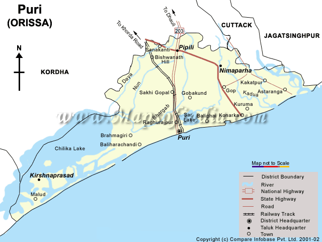
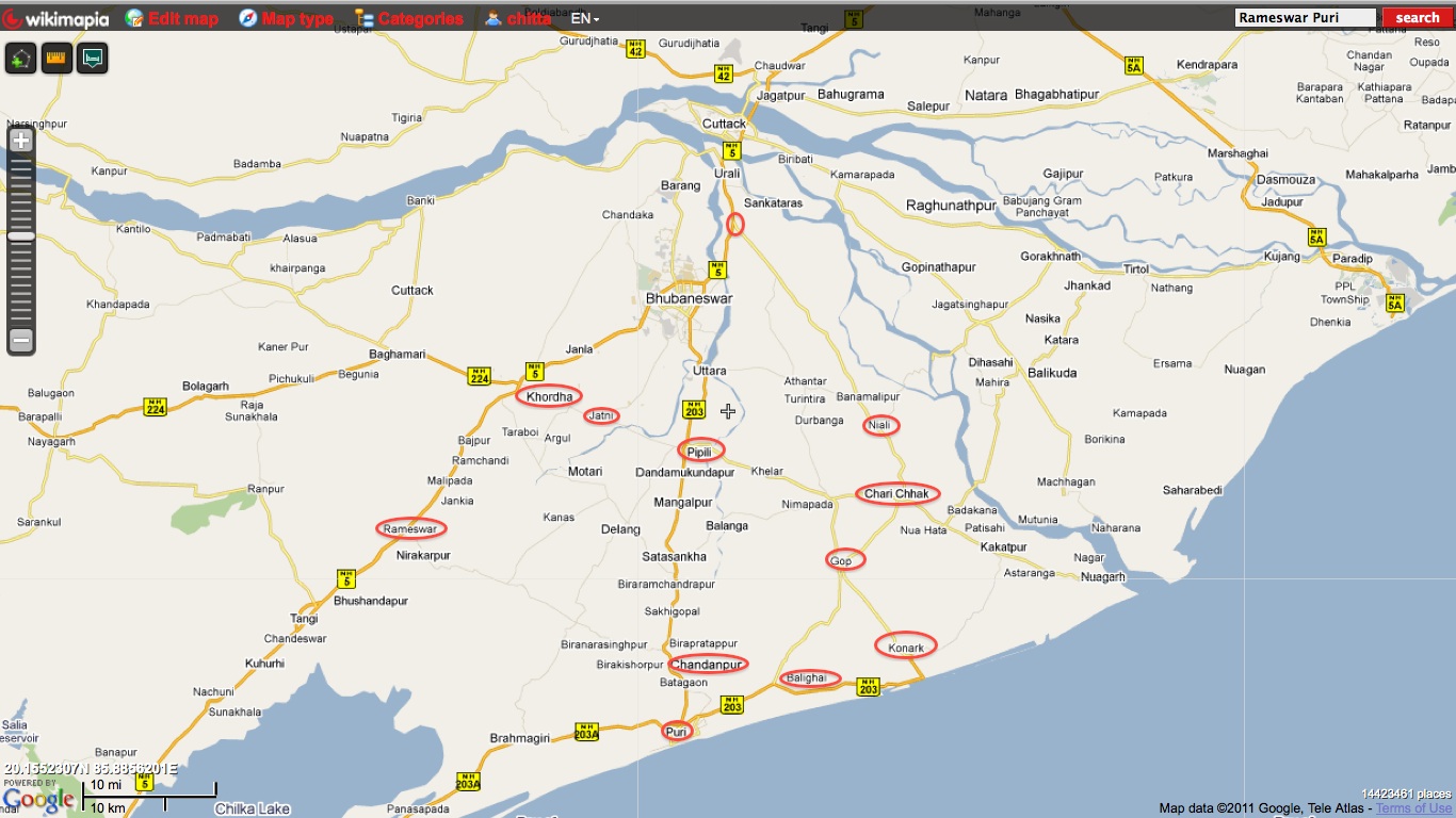
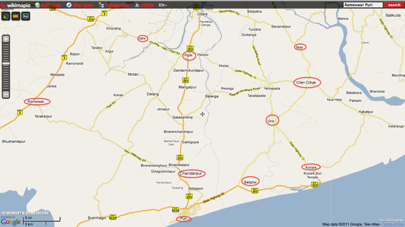
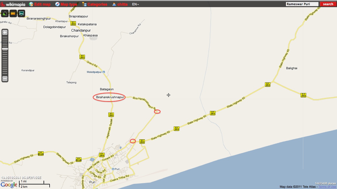
The following maps show the location of some of the names mentioned above.

One interesting point to note is that Puri district’s area is 3,479 sq. km, which is comparable to Goa’s 3,702 sq km. Population wise they are also comparable. Goa’s population is 1.4 million while Puri district’s population is about 1.5 million.

Past the Nabakalebar in 2015, the Odisha government may think of building up on the infrastructure and try to benchmark Puri district with respect to Goa. It may also consider to make it a special district with some special laws that will allow it the flexibility to become as big a tourist hub (or bigger) than Goa, minus the negatives.

OSRP – Orissa State Road Project

Odisha govt. action, Orissa State Road Project, Roads, highways and Bus stands, State highways, World Bank Comments Off on OSRP – Orissa State Road Project

The Orissa State Road Project web site is at http://osrp.gov.in/index.htm. It has a nice detailed map of roads in Orissa. The following details is from its "About Us" page.


The State Govt. during January 2005 had proposed to avail loan from World Bank and JBIC (Japan Bank for International Co-operation) for improvement of the state roads. The proposals were sent to the World Bank and JBIC through the Ministry of Road Transport and Highways and Department of Economic Affairs, Govt. of India.

The proposals were approved by the SLPMC on EAP (State Level Project Monitoring Committee on External Aided Project), chaired by the Chief Secretary, Orissa, on 20.01.05. The preliminary proposals included 27 nos. of road project under World Bank Scheme and 14 road projects under JBIC scheme. The project cost proposed under JBIC was Rs. 715.34 Crores for 805 Km of state road and that under World Bank Rs. 1642.44 Crores for 2197 Km of state road.

The Department of Expenditure, Ministry of Finance, Govt. of India gave clearance to the proposed World Bank project in their letter dated 07.04.2005 addressed to the State Govt. (Finance Department). However, the proposed JBIC road project has not yet been approved / cleared by the Govt. of India.

After clearance from Govt. of India, a full identification mission from the World Bank comprising Dr.Binyam Reja (Task Team Leader), A.K. Swaminathan (Sr. Transport Specialist), Mohammad Hassan (Sr. Social Development Specialist), and Ernst Hunning (Institutional Development Consultant) visited the State from April 14-22, 2005 to initiate the preparation of the proposed Orissa State Roads Project (OSRP). The mission met with concerned officials of the Government of Orissa (GOO) and senior management of the Orissa Works Department (OWD), and carried out field visits to some of the proposed roads.

During the April 2005 World Bank Identification Mission, it was agreed that, detailed project preparation for the proposed road network shall commence in a phased manner in three phases i.e Phase-I, Phase-II & Phase-III ( Para -11 & Para-27 (b) , (e) : April 2005 Aide Memoir of World Bank).

The World Bank team had discussed with the Finance Department for Plan provisions and necessary counterpart funding. After a detail discussion, the World Bank had agreed to:

                a.         Fund a Project for improvement Road infrastructure amounting to Rs. 1200 Cr. Out of which state has to bear Rs. 200 Cr as counterpart funding. Total World Bank loan ceiling shall be US$ 225 Million.

                b.         High density road corridors having sufficient economic viability of about 1200  1400 Kms shall be included in the project.

                c.         Balance roads shall be identified after carrying out a network analysis and economic viability from the balance 3700 Kms of State Highways in other phases subsequently.


–     At the preliminary stage, identified about 825 Km of Road Stretches to be included in the

Phase-I of the Project. These roads were selected from the earlier dropped project for

which a full-scale techno-economic feasibility study was carried out.

1              Jagatpur  Salepur  Kendrapara  Chandbali  Bhadrak (SH9 & SH 9A) -152 Km

2              Bhadrak  Anandpur  Karanjia  Tongabilla (Jashipur) (SH 53 & SH 49) -142 Km

3              Khariar  Bhawanipatna  Muniguda  Rayagada  Kereda (SH 16, SH 6 & MDR 48b) -213 Km

4              Berhampur  Rayagada (SH 17 & SH 4)          -201 Km

5              Banarpal  Daspalla (MDR 18, MDR 18A & MDR 64)    -89 Km

6              Bhanjanagar -Aska (SH  7)               -38Km


The World Bank however desired to check the viability of these roads by carrying out an updated techno-economic feasibility study.

The project also includes identification of road stretches to be taken up in Phase  II of the project after carrying out network analysis for all State roads.

Accordingly a domestic Consultant has been engaged from Govt of Orissa s own resources to carryout:

1              the Economic viability of Phase  I Roads;

2              the feasibility study & DPR of Phase  I Roads and

3              the network analysis of all State Highways of the State and identification of phase II roads.


   The World Bank Mission had:

–     Agreed for a Project for improvement of about 1200  1400 Km State Roads with a

Project size of Rs. 1480 Cr. (US$ 315 Million) with loan component of Rs. 1175 Cr. (US$

250 Million) and counterpart funding of Rs. 305 Cr. (US$ 65 Million);

The World Bank team again visited the state during September 2005 and inspected the roads proposed by the State Government to finalise roads for inclusion in Phase-I of the project (Para -12 & Para-14 : September 2005 Aide Memoir of World Bank) . During the said visit, some of the important roads proposed under JBIC assistance (Japan Bank for International Co-operation ) was included in the Phase-I list of World Bank roads after discussion with the World Bank, since the proposal submitted to JBIC was not cleared by the Dept. of Economic Affairs, Govt. of India.

1              Jagatpur  Salepur  Kendrapara  Chandbali  Bhadrak (SH9 & SH 9A) -152 Km

2              Bhadrak  Anandpur  Karanjia  Tongabilla (Jashipur) (SH 53 & SH 49) -138Km

3              Khariar  Bhawanipatna  Muniguda  Rayagada  Kereda (SH 16, SH 6 & MDR 48b) -223 Km

4              Berhampur  JK Pur _ Rayagada (SH 17 & SH 4)          -202 Km

5              Banarpal  Daspalla -Bhanjanagar -Aska (MDR 18, MDR 18A & MDR 64,SH  7)) -201Km


Approval from Hon ble Chief Minster to the roads proposed under Phase-I of World Bank scheme, covering a total length of 835 Km was obtained during October 2005, so as to proceed for detailed feasibility, economic analysis and other associated studies for Detailed Project Preparation and bidding. The major criteria used for selection of these roads were traffic volume, carriageway width, pavement conditions, economic activity in the influence area of the road, and connectivity of the roads.

Subsequently, after consideration of the Feasibility Study prepared by the DPR Consultant, the World

Bank Mission during their visit to the State in November 6-10, 2006 have decided to improve the

following roads in the Year  I of the Project.

1              Chandabali  Bhadrak  Anandapur

2              Khariar  Bhawanipatana

3              Berhampur  Taptapani


The World Bank had suggested to carryout detail economic viability and feasibility study for the 835 Km roads proposed under Phase-1 and Network Analysis of the entire State Highway Network ( covering about 3955 Km, leaving 835 Km Phase-1 roads ) for identification / prioritization of 1600 Km roads for improvement in Phase-II & Phase-III ( Para -11 & Para-27 (a), (e) : April 2005 Aide Memoir of World Bank). They had suggested to use the latest traffic and road condition survey data so as to assess which roads should fall under rehabilitation, and which roads should fall under upgrading in the detailed economic analysis.

Accordingly, economic viability and detailed feasibility study for the 835 Km roads proposed under Phase-1 and Network Analysis of the entire State Highway Network ( covering about 3955 Km, leaving 835 Km Phase-1 roads ) for identification / prioritization of 1600 Km roads for Phase-II & Phase-III were carriedout with help of a domestic consultants. M/S CEG Ltd from Rajasthan. The economic justifications of proposed road improvements under Phase-1 have been analyzed by using the life cycle costing economic tool ! Highway Development and Management Model (HDM-4) version 1.3" of World Bank. The economic evaluation has been carried out on the basis of incremental costs and benefits comparing the total net benefits with various alternatives. The economic indicators like NPV (Net Present Value) and EIRR ( Economic Internal Rate of Return) are then calculated. The final list of roads included in Phase-I alongwith summary of their techno-economic analysis with NPV, EIRR and ratio of NPV and cost etc. is shown at Annexure-I: The EIRR of each of the five corridors under Phase-1 varies from 30.53% to 17.28% with NPV of Rs 13172.8 million. It may be noted that the roads with EIRR more than 12% are considered financially viable under the World Bank loan.

 The World Bank had further intimated that the Project shall include

Institutional Reform of the Works Department, as per the Institutional Strengthening Action Plan (ISAP) prepared by the Task Force constituted by Government;

Identification of Roads to be improved under Public Private Partnership (PPP) mode with Viability Gap Funding from Govt. of India and World Bank along with preparation of necessary legal frameworks and documents;

Establishment of a Road Asset Management System for Works Department


Following is an excerpt from a report in Business Standard about some recent approvals with respect to this project.


These districts are Malkangiri, Raygada, Ganjam, Koraput and Sambalpur and the road projects would involve an estimated expenditure of Rs 400 crore.

The Union government has agreed to provide the funds for five to six road projects in those affected areas and out of it, it has sanctioned three. The roads which have been sanctioned are Samasinga (Sinduraparua)-Sambalpur, Parlakhemundi-Mohana via R Udayagiri and Gunupur-Andhra border via Kashipur, sources said. The state works department has sent the detailed project report (DPR) for these roads to the Centre.

“The basic work for these roads have started and the work is likely to start after 3-4 months after the tender process is over”, a senior official of the state works department said.

Meanwhile, a team of the World Bank visited the new road sites being taken up under Orissa State Road Project (OSRP). …

These patches are construction of the 68-km Bhawanipatna-Khariar road, 95 km long Chandbali-Bhadrakh-Anandapur road and 41 km Berhampur-Taptapani road. After some delay in those projects, the work have finally taken off, sources added.

Construction of 204 kms of roaddsare proposed to be constructed in the first phase under the Orissa State Road Project (OSRP).Similarly, the construction of 257 kms of road will be taken up in the second phase of OSRP. This includes Taptapani-Raipanka road (68 km), Raipanka-JK Pur (83km) and Jagatpur-Chandabali (106 km).


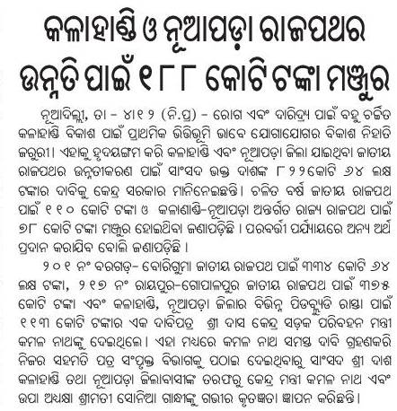
Kudos to MP Bhakta Das for getting 188 crores allocated for Kalahandi and Nuapada highways: Samaja

Kalahandi, NH 201 (310 Kms: Boriguma - Bhawanipatna - Balangir - Bargarh), NH 217 (438 Kms: Chhattisgarh Border - Khariar Rd - Nuapada - Khariar - Titlagarh - Ramapur - Baligurha - Asika - Brahmapur - Gopalpur), Nuapada, Odisha MPs, State highways 2 Comments »

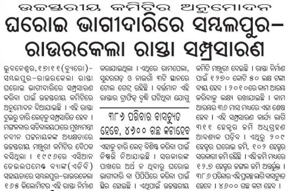
HLCA approves 4-laning of Sambalpur-Rourkela via PPP: Dharitri

High Level Committee, Jharsugurha, PPP, Rourkela- Kansbahal, Sambalpur, Sambaplur- Burla- Bargarh- Chipilima, State highways, Sundergarh 3 Comments »

Tathya.in has some interesting tidbits on this. Following is an excerpt.

Minister was speaking in the High Level Clearance Authority (HLCA) on 17 November.

HLCA Chaired by Naveen Patnaik cleared the proposal of 4-laning of Sambalpur-Rourkela Highway on PPP Mode with an investment of Rs.1270 crore.

He said by slapping tool tax on the commuters and funding the project is passé.

Now while roads are coming up in a big way, lands are identified at some vantage points by the side of the roads.

These places can be handed over to the developers so that they can develop shopping malls, housing projects and this should be included in the package.

And this initiative will lessen the burden of tax payers, who are forced to pay huge toll tax for years to come.

Secondly Minister said that while we are going for expansion of the Highways, encroachment of land is posing a big problem.

… It would be a better proposition to acquire land and lay the road in such a way that more space is left inwards.

So that later that space can be used for expansion of roads and no body will be able to encroach upon and inside the highway, said the Minister.

Demand to make Barang-Tikarpada a state road: Samaja

Cuttack, State highways Comments Off on Demand to make Barang-Tikarpada a state road: Samaja

Roads and Highways infrastructure in Orissa

Angul, Balangir, Balasore, Bargarh, Baripada-Balasore-Kirtania, Bhadrakh, Bhadrakh-Balasore, Bhadrakh-Dhamara, Bhubaneswar-Berhampur, Bhubaneswar-Cuttack- Kalinganagar, Bhubaneswar-Dhenkanal- Anugul, Bhubaneswar-Nayagarh, Bhubaneswar-Paradip, Bhubaneswar-Pipli- Astaranga, Bhubaneswar-Pipli- Konark, Bhubaneswar-Puri, Bouda, Choudwar-Kendrapara - Dhamara, Coastal highway, Corridors emanating from Bhubaneswar metro, Cuttack, Cuttack-Paradip, Deogarh, Dhenkanal, DISTRICTS & BLOCKS, Gajapati, Ganjam, Grama sadak, Jagatsinghpur, Jajpur, Jharsuguda-Sambalpur- Bargarh, Jharsugurha, Kalahandi, Kalinganagar - Kamkhya Nagar - Talcher, Kalinganagar - Panikoili - Jajpur - Kendrapara, Kalinganagar - Tarini - Keonjhar, Kalinganagar- Chandikhol- Paradip, Kalinganagar-Bhadrakh, Kandhamala, Kendrapada, Keonjhar, Khordha, Koraput, Malkangiri, Mayurbhanj, Mining Corridor, Nabarangpur, National Highways, Nayagarha, NH 200 (440 Kms: Chhattisgarh - Jharsuguda - Deogarh - Talcher - Kamakhyanagar - Duburi - Chandhikhol), NH 201 (310 Kms: Boriguma - Bhawanipatna - Balangir - Bargarh), NH 203 (97 Kms: Bhubaneshwar-Pipili-Puri-Konark), NH 203A (49 Kms: Puri - Bramhagiri - Satpada), NH 215 (348 Kms: NH-5@Panikoli - Anandapur - Kendujhargarh -Rajamundra @NH-23), NH 217 (438 Kms: Chhattisgarh Border - Khariar Rd - Nuapada - Khariar - Titlagarh - Ramapur - Baligurha - Asika - Brahmapur - Gopalpur), NH 224 (298 Kms: Khordha - Nayagarh - Dashapalla - Bauda - Sonapur - Balangir), NH 23 (209 Kms: Jharkhand Border - Rourkela - Rajamundra - Pala Laharha - Talcher - NH-42), NH 42 (261 Kms: NH-6@Sambalpur - Redhakhol - Anugul - Dhenkanal - NH-5@Nergundi), NH 43 (152 Kms: Chhattisgarh Border - Chandili - Borigma - Jaypur - Koraput - Sunki - Andhra Pradesh Border), NH 5 (488 kms: NH No.6 in Jharkhand - Baripada - Baleshwar - Bhadrakh - Cuttack - Bhubaneswar - Khordha - Brahmapur - upto Andhra Pradesh Border), NH 5A (77 Kms: NH-5 at Chandikhol to Paradip), NH 6 (462 Kms: Chhattisgarh Border - Lobarchatti - Bargarh - Sambalpur - Deogarh - Kendujhargarh - Jashipur - Bangriposi - Jharkhand Border ), NH 60 (57 Kms: West Bengal Border- Jaleswar - Baleshwar), NH 75 (18 Kms: Jharkhand Border to NH-215 near Parsora), Nuapada, Overall Odisha, Puri, Puri - Konark, Rayagada, Road maps, Roads, highways and Bus stands, Rourkela-Jharsuguda, Sambalpur, Sonepur, State highways, Sundergarh, Vijaywada-Ranchi highway Comments Off on Roads and Highways infrastructure in Orissa


In recent years there has been a big jump in the number of kilometers of national highways in Orissa. Following is copied from my page "Roads and Highways infrastructure in Orissa."

Road network: Orissa Roads1; Orissa Roads2; India’s NH network; India’s golden quadrilateral; the part of the GQ/NH-5 that runs through Orissa.

  • National Highways in Orissa and India; its growth in recent years:
    • NH 5: Junction with NH No.6 in Jharkhand near Baharagora-BaripadaBaleshwar-Bhadrakh-Cuttack- Bhubaneswar-Khordha-Chhatrapur-Brahmapur– upto Andhra Pradesh Border. (488 kms)
    • NH 5A: Junction with NH No.5 near Haridaspur-Paradip Port. (77 kms)
    • NH 6: From Chhattisgarh Border-Lobarchatti- BargarhSambalpur-Deogarh-Barakot- Kendujhargarh -Jashipur-Bangriposi-upto Jharkhand Border (462 kms)
    • NH 23: From Jharkhand Border-Panposh-Raurkela– Rajamundra-Barakot- Pala Laharha-Talcher-Jn. with NH-42 (209 kms)
    • NH 42: Junction with NH No.6 near Sambalpur– Redhakhol-Anugul-Dhenkanal- Jn. with NH-5 near Cuttack. (261 kms)
    • NH 43: From Chhattisgarh Border– Dhanpunji- Borigma- JaypurKoraput-Sunki- Andhra Pradesh Border. (152 kms)
    • NH 60: From West Bengal BorderJaleswarBaleshwar (57 kms)
    • NH 75: From Jharkhand Border to junction with NH No.215 near Parsora (18 kms)
    • NH 200: From Chhattisgarh-Machida-Jharsuguda– Kochinda- Deogarh –Talcher-Kamakhyanagar-Sukinda- Chandhikhol (440 kms)
    • NH 201: Boriguma-Ampani-Bhawanipatna– Belgan- Balangir-Luisinga-Jogisuruda-Dunguripali-Bargarh (310 kms)
    • NH 203: Bhubaneshwar-Pipili-PuriKonark (97 kms)
    • NH 203A: The highway starting from its junction with NH-203 at Puri, connecting Bramhagiri and terminating at Satpada (49 kms)
    • NH 215: Panikoli-Anandapur-Ghatgan- Kendujhargarh– Parsora-Koira-Rajamundra (348 kms)
    • NH 217: From Chhattisgarh Border-Nauparha-Khariar- Titlagarh-Belgan- Ramapur- Baligurha-Sorada-Asika- Brahmapur– Narendrapur- Gopalpur (438 kms)
    • NH 224: Khordha-Nayagarh-Dashapalla- Purunakatak-Bauda-Sonapur-Balangir (298 kms)
  • Vijaywada-Ranchi highway (approved by planning commission as reported in May 2006), [July 06] [The Orissa government has been demanding a NH from Vijaywada to Ranchi which will pass through the Naxal infested areas. 1200 km of this 2000km will be in Orissa. CM talked to planning comission about it.]
  • Ongoing National Highway work in Orissa
  • Future plans for Orissa: [1:april-28-05]; [2:april-28-05].
  • Various phases of NHDP: [1]; [2]; [3]
  • Other highway plans:
    • 4 laning of Chandikhol-Paradip by February-end of 2007
    • 4 laning of Keonjhar-Panikoili, Duburi-Talcher, Cuttack-Paradeep and Duburi-Keonjhar Highways. [June17-05-Pragativadi]
  • Aim-for-with-high-priority/parts-of-it-in-Orissa-govt- plan(page4)-already:
    • Connect NH 215 (perhaps at Jajpur Rd) to Jenapur to NH200 (where it meets Brahmani) with a highway as Jenapur is the location where the National waterway will cross the railway line and Jenapur is 7 kms from where a branch of the line goes to Daitari and Bansapani.
    • Designate AP-border-Koraput-Raygada-Padampur- Berhampur (in NH5) as a National highway. (This will bring Koraput and Raygada, thus a big part of KBK, closer to BBSR) — a slight revision of what is in the plan
    • Designate Anandpur (NH 215)-Bhadrak-Dhamara port as an NH. (This will bring Dhamara port closer to Jharkhand, thus helping industries in Jharkhand and Orissa.)
    • Jagatpur-Kendrapara-Chandbali-Dhamara — make it an NH (alternative route to Dhamara port)
    • Panikoili/Kuakhia-Jajpur-Aradi-Chandabali — make it an NH (alternative route to Dhamara port)
    • Panikoili-Jajpur-Kendrapara-NH5a-Paradeep — make it an NH (alternative to Paradeep port)
  • Orissa State Road Transport Company (OSRTC)
  • Wide city roads:
    • Four-laning of the Airport-Dhamana Chhaka road in Bhubaneswar: [1]
    • Other Bhubaneswar Road plans: [1], [2]
  • Bhubaneswar area road plans: